鸟瞰弗吉尼亚爬山虎步道,达马斯克斯,弗吉尼亚州,美国 Aerial view of the Virginia Creeper Trail, Damascus, Virginia, USA (© Eifel Kreutz/Getty Images)

鸟瞰弗吉尼亚爬山虎步道,达马斯克斯,弗吉尼亚州,美国 Aerial view of the Virginia Creeper Trail, Damascus, Virginia, USA (© Eifel Kreutz/Getty Images)
穿越时光的足迹 Trailing through time
弗吉尼亚爬山虎步道, 达马斯克斯, 弗吉尼亚州
有些铁路会退出历史舞台,而“弗吉尼亚爬山虎步道”则实现了华丽转身。这条步道全长34.3英里,横贯弗吉尼亚州西南部,沿用了一条昔日的铁路线——该线路曾用于在阿巴拉契亚山脉间运输木材和铁矿石。步道那独特的名字,源自20世纪初那些在陡峭坡道上艰难爬行的蒸汽机车。
这条步道以被誉为“美国步道之城”的大马士革为中心,因其47座木制栈桥、壮丽的山景和丰富的户外探险活动而闻名。大马士革也是为数不多的阿巴拉契亚步道直接穿过镇中心主街的地点之一。
这条步道的一大亮点是从怀特托普站到大马士革长达17英里的下坡骑行路段;怀特托普站是全线最高点,海拔3,500英尺。骑行者几乎无需踩踏踏板,即可顺势滑行下降约1,600英尺。另一处引人注目的景观是“高架栈桥”,这是一座长550英尺、高出下方山谷100英尺的桥梁。受2024年“海伦”飓风破坏影响,该步道的上段目前因修复工作而关闭,而大马士革至阿宾登的路段则继续开放。
Virginia Creeper Trail, Damascus, Virginia
Some railways retire. The Virginia Creeper Trail simply changed gears. Stretching 34.3 miles through southwest Virginia, this trail follows a former rail line once used to haul lumber and iron ore through the Appalachian Mountains. Its unusual name traces back to the steam locomotives that labored up steep grades in the early 1900s.
Centered around Damascus, known as 'Trail Town USA,' the trail is famous for its 47 wooden trestles, sweeping mountain views, and outdoor adventures. Damascus is also one of the few places where the Appalachian Trail passes directly through a town's Main Street.
One of the trail's highlights is a 17-mile downhill ride from Whitetop Station, the route's highest point at 3,500 feet, to Damascus. Riders can coast nearly 1,600 feet downhill with little pedaling. Another standout feature is the High Trestle, a 550-foot bridge that rises 100 feet above the valley below. Following damage from Hurricane Helene in 2024, the upper section remains closed for restoration, while the Damascus-to-Abingdon section continues to stay open.
仙纳度国家公园的玳瑁峰, 弗吉尼亚州, 美国 Hawksbill Mountain in Shenandoah National Park, Virginia, USA (© John Baggaley/Getty Images)

仙纳度国家公园的玳瑁峰, 弗吉尼亚州, 美国 Hawksbill Mountain in Shenandoah National Park, Virginia, USA (© John Baggaley/Getty Images)
静谧之巅,喧嚣之景 Quiet peak, loud view
仙纳度国家公园的玳瑁峰, 弗吉尼亚州
究竟要多高,才能尽享绝佳美景?在美国东部,其实无需太高的海拔。位于弗吉尼亚州仙纳度国家公园(Shenandoah National Park)内的玳瑁峰(Hawksbill Mountain),海拔仅为4050英尺;这充分表明,对于这些古老的山脉而言,开阔的视野远比绝对的高度更为重要。该公园成立于1935年,其建立过程伴随着大规模农耕与伐木活动之后的植被恢复工作。如今,昔日的土地大都已重披林装,孕育着混交阔叶林、山月桂以及杜鹃花等丰富的植被。此外还有什么值得一提?公园内的部分岩石距今已逾10亿年,堪称该州最为古老的岩层之一。这里栖息着200多种鸟类和32种鱼类;同时,公园对宠物也十分友好,允许游客携带爱犬进入露营地及大多数步道。
玳瑁峰(Hawksbill)的峰顶并非由陡峭的悬崖构成;取而代之的是,一座由“平民保护团”(Civilian Conservation Corps)于20世纪30年代修建的石质平台标志着这里的最高点。从此处眺望,连绵的山脊向远方层层延伸,呈现出柔和的淡蓝色调——这一景象正是由大气散射效应所致。“天际线公路”(Skyline Drive)将游客引向通往此类山峰的各处登山步道起点。
Hawksbill Mountain in Shenandoah National Park, Virginia
How high is high enough for a great view? In the eastern United States, it doesn't take much. Hawksbill Mountain is the highest point in Shenandoah National Park, Virginia, at 4,050 feet, showing how these older mountains rely on openness, not elevation. The park's establishment in 1935 involved reforestation after extensive farming and logging. Today, much of that land has returned to forest, supporting mixed hardwoods, mountain laurel, and rhododendron. What else? Some of the rocks found here date back over 1 billion years, among the oldest in the state. The park shelters over 200 bird species and 32 species of fish and remains dog friendly, allowing pets in campgrounds and on most trails.
Hawksbill's summit does not rely on steep cliffs. Instead, a stone platform built in the 1930s by the Civilian Conservation Corps marks the top. From here, ridges stretch into the distance in soft blue layers, an effect caused by atmospheric scattering. Skyline Drive connects visitors to trailheads leading to peaks like this.
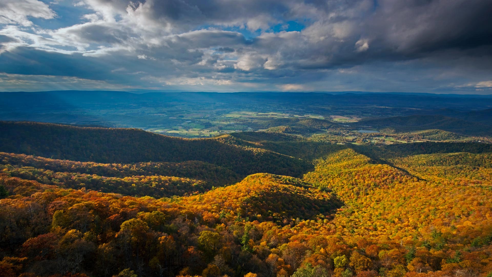
仙纳度国家公园的秋色,弗吉尼亚州 Fall colors in Shenandoah National Park, Virginia (© Michael Ver Sprill/Getty Images)

仙纳度国家公园的秋色,弗吉尼亚州 Fall colors in Shenandoah National Park, Virginia (© Michael Ver Sprill/Getty Images)
啊!仙纳度 Oh Shenandoah
仙纳度国家公园,弗吉尼亚州,美国
漫山红遍的十月就要来了,是时候开启新的篇章了。仙纳度国家公园坐落在蓝岭山脉深处,覆盖了20万英亩的土地。在夏日将尽之际,公园正在脱胎换骨,准备向世人展现它最迷人的季节:秋季。树叶换上了最迷人的盛装:红色、橙色、还有金色……色彩交织展现出不容错过的美景。天际线大道是一条105英里长的公路,沿途有超过75处观景台,为你提供第一线的美景。你知道在仙纳度生长着超过300个种类的植物吗?糖枫、山核桃、橡树都是这场色彩游戏中的“摇滚巨星”。所以,无论你是徒步爱好者、自然摄影师、或者只想寻找宁静的避世之地,这个公园都能满足你所有需求。
Shenandoah National Park, Virginia
'Oak'tober is upon us and that means it's time to turn over a new leaf! Nestled in the heart of the Blue Ridge Mountains, Shenandoah National Park spans over 200,000 acres. As summer bids farewell, the park undergoes a transformation, unveiling its most enchanting chapter: the fall season. The leaves put on their fanciest outfits—reds, oranges, and golds—creating an amazing show you won't want to miss.
The Skyline Drive, a 105-mile route, offers a front-row seat, with more than 75 overlooks. And there are more than 300 species of trees, vines, and shrubs to see here. The sugar maples, hickories, and oaks are the rock stars of the color-changing game. So, whether you're an avid hiker, a nature photographer, or simply seeking a tranquil escape, this park has it all.
鸟瞰Mockhorn岛野生动植物管理区沼泽地内的潮汐通道,弗吉尼亚 Aerial view of tidal channels in marshland of the Mockhorn Island State Wildlife Management Area, Virginia (© Shane Gross/Minden Pictures)
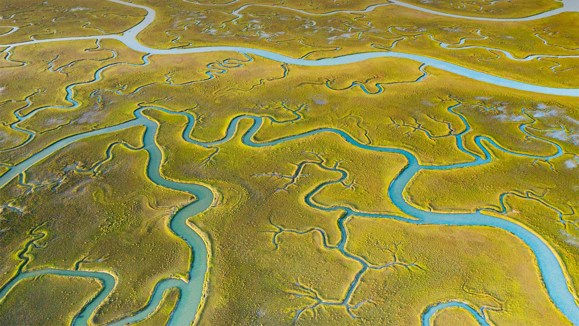
鸟瞰Mockhorn岛野生动植物管理区沼泽地内的潮汐通道,弗吉尼亚 Aerial view of tidal channels in marshland of the Mockhorn Island State Wildlife Management Area, Virginia (© Shane Gross/Minden Pictures)
When does the tide come in?
From the air, this tract of Mockhorn Island on the Atlantic coast of Virginia's Eastern Shore could pass for gentle farmland. But what you're really looking at is rugged tidal marshland, visible when the tide is out—the rest of the time, much of this area is underwater. Mockhorn is itself part of Virginia's coastal island chain called the Barrier Islands, which run down the east coast of the state from the Maryland-Delaware border for about 70 miles, stretching to the mouth of Chesapeake Bay. The green vegetation you see is grass, although not the kind you'll find in a suburban lawn. Instead, it's saltmarsh cordgrass, a type of perennial deciduous species that grows in wetlands and salt marshes like this one.
The only way to access the tidal channels of Mockhorn Island is by boat, and plenty of kayakers, hunters, and sport fishers are willing to brave the fickle, windy weather to enjoy the island's labyrinth of sloughs, bays, and inlets. The area's also a great destination for bird watchers, as many bird species fly directly overhead while migrating. Historically, the rugged terrain and remote location of the Barrier Islands made them a great place for those running from the authorities—it's said that pirates, including Blackbeard himself, spent time in hiding in the backwaters of this rugged coast.
潮水什么时候来?
从空中看,这片位于弗吉尼亚东岸大西洋海岸的莫克霍恩岛可以算是一片温和的农田。但你真正看到的是崎岖不平的潮汐沼泽地,其余时间退潮时可见,这一地区大部分都在水下。莫克霍恩岛本身是弗吉尼亚州海岸岛链的一部分,称为障壁群岛,从马里兰州与特拉华州的边界沿该州东海岸延伸约70英里,一直延伸到切萨皮克湾的河口。你看到的绿色植被是草,虽然不是你在郊区草坪上看到的那种。取而代之的是盐沼灯心草,一种多年生落叶植物,生长在湿地和盐沼中。
进入莫克霍恩岛潮汐通道的唯一途径是乘船,许多皮划艇手、猎人和运动渔民都愿意冒着变化无常、刮风的天气,享受岛上迷宫般的泥沼、海湾和水湾。该地区也是鸟类观察者的好去处,因为许多鸟类在迁徙时直接从头顶飞过。从历史上看,障壁岛崎岖的地形和偏远的地理位置使它成为那些逃避当局的人的好去处。据说海盗,包括黑胡子本人,都在这个崎岖的海岸的穷乡僻壤中躲藏了一段时间。