2012年5月20日新墨西哥上空的日环食 Annular eclipse over New Mexico, May 20, 2012 (© ssucsy/Getty Images)
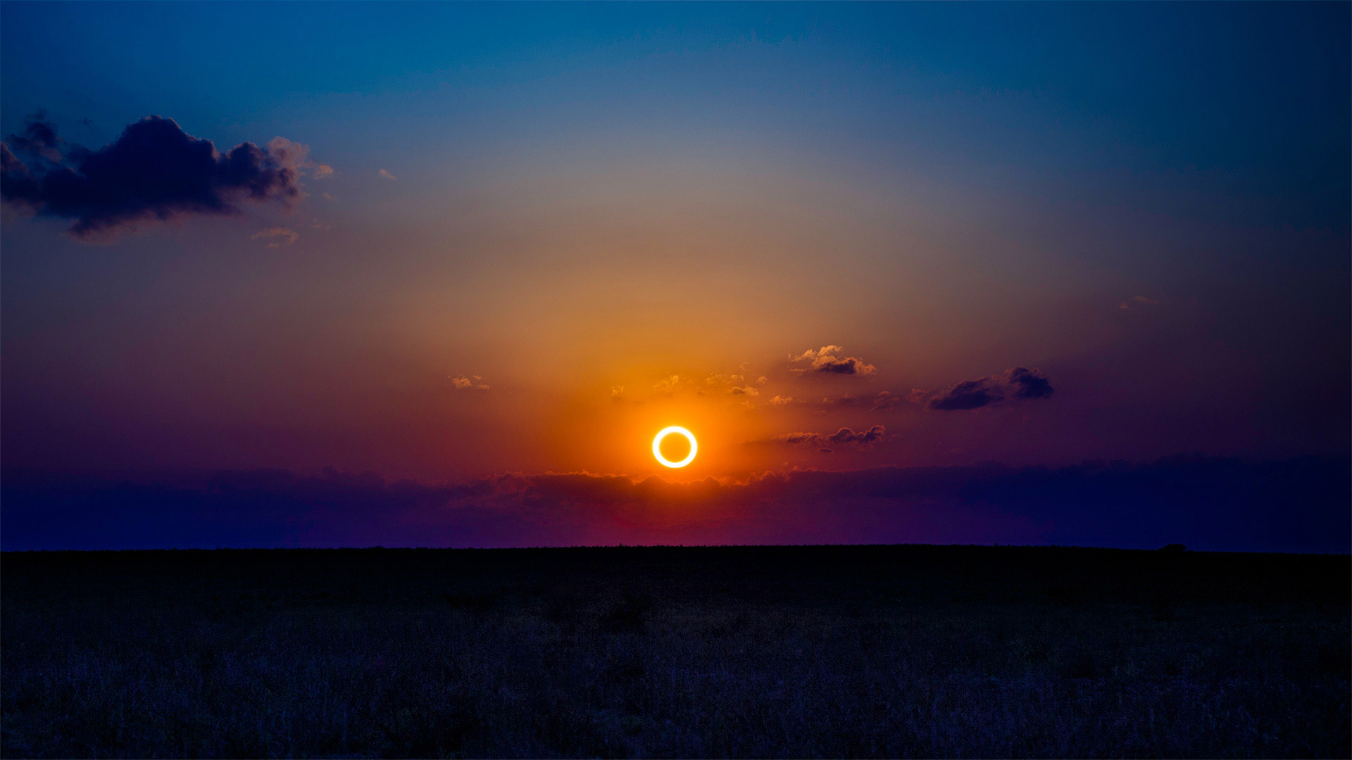
2012年5月20日新墨西哥上空的日环食 Annular eclipse over New Mexico, May 20, 2012 (© ssucsy/Getty Images)
Ring of fire
No, this isn't some kind of early promo for 'Halo: Infinite.' Today's homepage image shows an annular solar eclipse captured in New Mexico in 2012. ('Annular' is just a fancy word for doughnut-shaped.) It's not unlike the eclipse some northerly parts of the world will enjoy today.
Annular eclipses like today's occur when the moon is at its apogee, or the furthest distance in its orbit from Earth. Since the moon looks its smallest to us now, it can't fully cover the sun—but the lucky few living in far northern Canada, Scandinavia, and Siberia will have tickets to a one-ring solar circus once everything lines up just right.
火环
不,这不是“光环:无限”的早期宣传。今天的主页图片显示了2012年在新墨西哥州拍摄的一次日环食。(“日环食”只是甜甜圈形状的一个花哨的词。)这和今天世界上一些偏北地区将享受的日食没什么不同。
像今天这样的环食发生在月球的最远点,或者说是其轨道上离地球最远的地方。由于月球现在看起来是最小的,它不能完全遮住太阳,但生活在遥远的加拿大北部、斯堪的纳维亚半岛和西伯利亚的少数幸运儿,一旦一切都安排得恰到好处,就会有单圈太阳马戏团的票。
红石公园教堂岩附近的雷击,新墨西哥州 Lightning strikes near rock formation, Church Rock, Red Rock Park, New Mexico (© Tim Fitzharris/Minden Pictures)
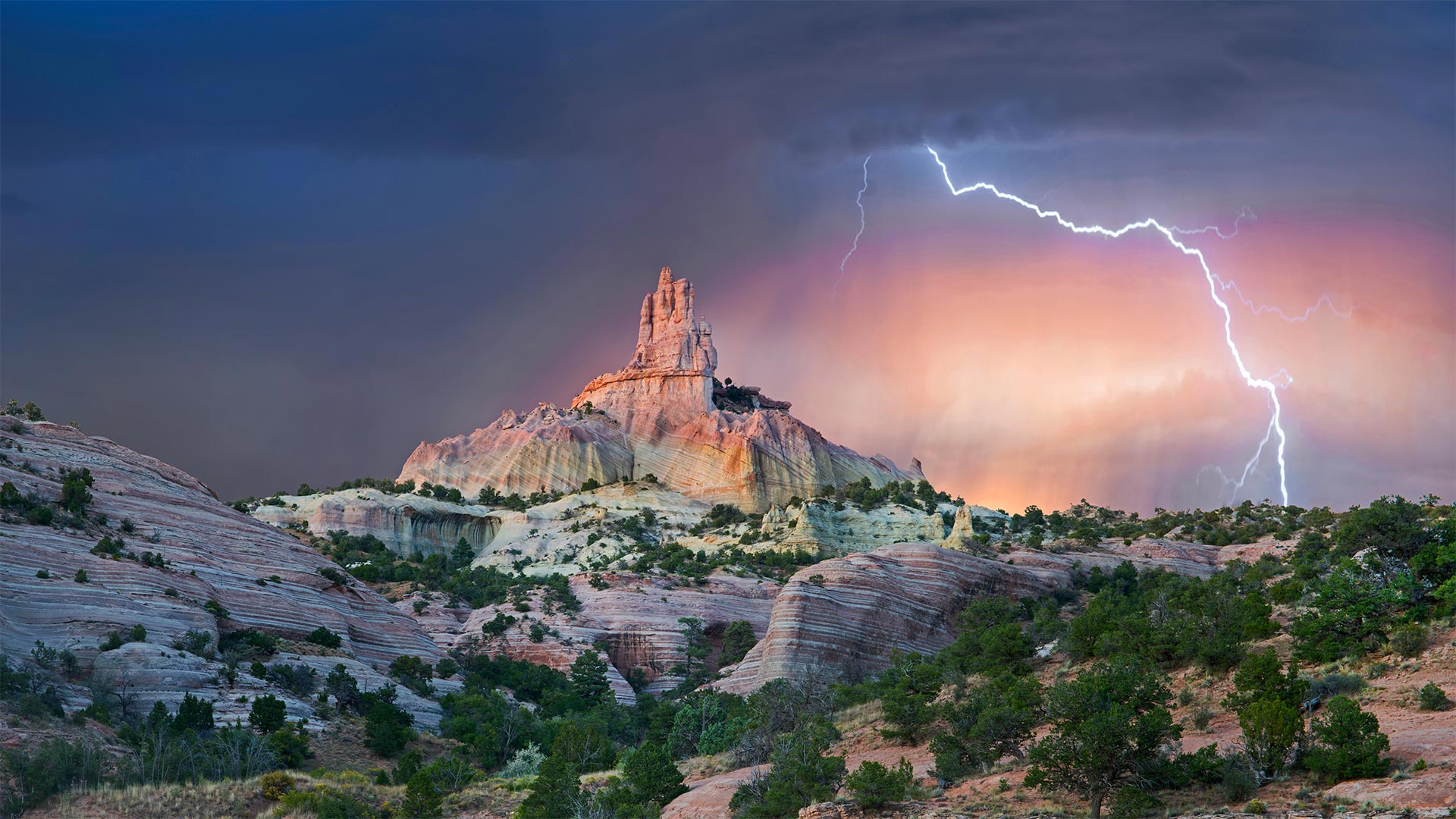
红石公园教堂岩附近的雷击,新墨西哥州 Lightning strikes near rock formation, Church Rock, Red Rock Park, New Mexico (© Tim Fitzharris/Minden Pictures)
Struck by Southwestern beauty
It's okay if this stormy shot stirs your spirit with holy awe: They call this wind-carved edifice Church Rock for a reason. Surrounded by an enchanting Southwestern landscape, it's a sight that almost invites you to get lost out here—and if you look at a map of these parts, you'll see that's not too hard.
We're in the 'checkerboard' region of western New Mexico, where patchwork borders separate sovereign Navajo Nation grounds and private land from that administered by an alphabet soup of federal, state, and local agencies. (For its part, Church Rock was the crown jewel of a state park before it was returned to the Navajo in 1989, while the city of Gallup now maintains the nearby parkland.) Maybe it's simpler to think in terms of a more ancient boundary line: The Great Continental Divide, marking the border between North America's Atlantic- and Pacific-destined waters, crosses Route 66 just east of the checkerboard.
为西南美景所震撼
如果这狂风暴雨的镜头激起你神圣的敬畏,那也没关系:他们称这座风雕大厦为教堂岩石是有原因的。四周环绕着迷人的西南景观,这种景象几乎会让您迷失在这里——如果你看看这些地方的地图,你会发现这不是太难。
我们在新墨西哥州西部的“棋盘格”地区,这里的边界错落有致,将纳瓦霍族主权国家的土地和私人土地与联邦、州和地方机构管理的土地分隔开来。(教堂岩在1989年被归还纳瓦霍之前是国家公园的王冠宝石,而盖洛普市现在保留着附近的公园。)也许用一条更古老的边界线来思考更简单:大洲分水岭,在北美洲大西洋和太平洋水域之间的边界,穿过66号公路,就在棋盘的东边。
白沙国家公园中的石膏沙丘,新墨西哥 Gypsum sand dunes, White Sands National Park, New Mexico (© Grant Kaye/Cavan Images)
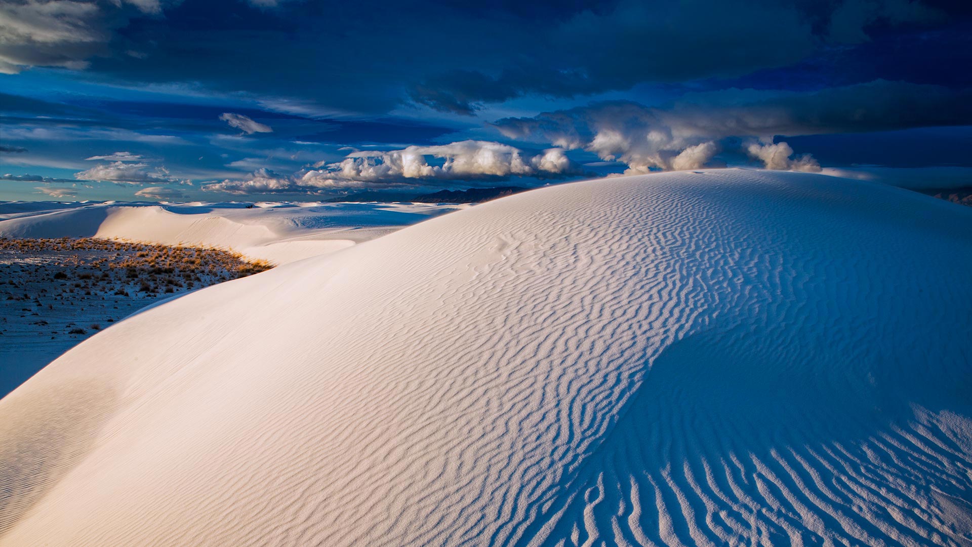
白沙国家公园中的石膏沙丘,新墨西哥 Gypsum sand dunes, White Sands National Park, New Mexico (© Grant Kaye/Cavan Images)
Sands of time
At a quick glance, you might mistake these dunes for massive snowdrifts. Although they do make for great sledding, the tiny crystals that make up White Sands National Park are not ice but gypsum, a soft mineral often used to make plaster and chalk. The dune field became a national monument on this day in 1933 with a proclamation by President Herbert Hoover, which set aside nearly 150,000 acres for preservation. Recently, on December 20, 2019, President Trump signed legislation making it the 62nd designated national park in the National Park System.
The pearly sands compose the largest gypsum dune field in the world but cover just a fraction of southern New Mexico's Tularosa Basin. This vast desert valley—more extensive than some US states at 6,500 square miles—is mostly occupied by White Sands Missile Range. The active military installation—the US's largest by area—surrounds the national park and includes the Trinity site, where the first atomic bomb was detonated in 1945. That event altered the course of humanity's future, but the White Sands region is also defined by echoes from our very distant past: recently, scientists have used radar technology to zero in on prehistoric human, mammoth, and giant sloth footprints buried long ago beneath the shifting sands.
International UFO Museum and Research Center, Roswell, New Mexico © Walter Bibikow/Danita Delimont
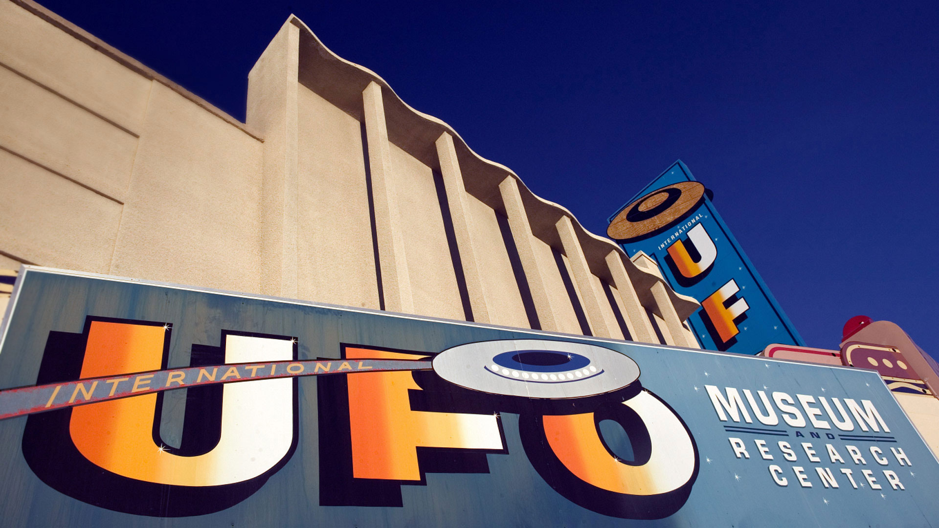
International UFO Museum and Research Center, Roswell, New Mexico © Walter Bibikow/Danita Delimont