菲安斯湖,格兰屏国家公园,维多利亚州,澳大利亚 Lake Fyans, Grampians National Park, Victoria, Australia (© tracielouise/Getty Images)

菲安斯湖,格兰屏国家公园,维多利亚州,澳大利亚 Lake Fyans, Grampians National Park, Victoria, Australia (© tracielouise/Getty Images)
倒影满湖的水库 A reservoir of reflections
菲安斯湖,格兰屏国家公园,维多利亚州,澳大利亚
乍看之下,今天的画面更像一片被淹没的林地,而不是湖泊。光秃的树干从水中伸出,倒影横贯水面,远处的格兰屏群山熠熠生辉。这里是菲安斯湖,一座位于澳大利亚维多利亚州格兰屏(加里维德)国家公园边缘的人工水库。这里深受划船者、垂钓者、帆船爱好者和滑水者欢迎,也为人们提供了欣赏澳大利亚最壮美景观之一的绝佳前排视角。
湖泊远处的群山属于格兰屏山脉,这条山脉历经数亿年塑造而成。如今,该地区以崎岖的砂岩山峰、壮观的观景台、瀑布和丰富的澳大利亚原住民文化遗产闻名。步道纵横交错,带领徒步者欣赏开阔景致,并邂逅袋鼠、鸸鹋及其他本土鸟类。菲安斯湖将这种荒野精神浓缩在同一幅画面中:被淹没的树木、开阔的天空,以及以古老群山构成的瞬息万变的背景。
Lake Fyans, Grampians National Park, Victoria, Australia
At first glance, today's image looks more like a drowned woodland than a lake. Bare tree trunks emerge from the water, their reflections stretching across the surface as the Grampians glow in the distance. This is Lake Fyans, an artificial reservoir on the edge of the Grampians (Gariwerd) National Park in Victoria, Australia. Popular with boaters, anglers, sailors, and water-skiers, it offers a front-row seat to one of the country's most striking landscapes.
The mountains beyond the lake are part of the Grampians, a range shaped over hundreds of millions of years. Today, the region is known for its rugged sandstone peaks, dramatic lookouts, waterfalls, and rich Aboriginal cultural heritage. Trails crisscross the park, leading hikers to sweeping views and encounters with kangaroos, emus, and other native birds. Lake Fyans captures that wild spirit in a single scene: flooded trees, open skies, and an ever-changing backdrop of ancient mountains.
陆地与海洋的鸟瞰图,维多利亚州,澳大利亚 Aerial view of land and ocean, Victoria, Australia (© Nearmap/Getty Images)

陆地与海洋的鸟瞰图,维多利亚州,澳大利亚 Aerial view of land and ocean, Victoria, Australia (© Nearmap/Getty Images)
陆地与海洋的鸟瞰图 The land of moving shorelines
陆地与海洋的鸟瞰图,维多利亚州,澳大利亚
维多利亚州位于澳大利亚东南部,坐拥由南大洋雕琢而成的绵延千余英里的海岸线。从高空俯瞰,这里的海滩宛如一条条宽阔的浅色沙带,边缘环绕着碧绿的海水与崎岖的峭壁。这种海陆交融的独特景致构成了该地区的主要魅力所在。著名的“大洋路”沿这段海岸线蜿蜒延伸约150英里,途经热门冲浪胜地、林木葱郁的海角以及各具特色的海滨小镇。
这里最引人注目的景观之一是“十二使徒岩”——这些高耸的石灰岩柱历经数百万年的风浪侵蚀而形成。附近海域既有像贝尔斯海滩那样海浪汹涌的冲浪胜地,也有宁静的海湾,那里沿海植被与开阔的沙滩交相辉映。远离海岸,农田与国家公园构成了别样的景致,不仅孕育着丰富的野生动植物,还设有风景优美的步道。维多利亚州首府墨尔本坐落于菲利普港湾畔,作为该州的核心城市,它彰显了这片土地兼具文化活力与自然多样性的特质——从高耸的阿尔卑斯山峰到原始粗犷的海岸线,风光无限。
Aerial view of land and ocean, Victoria, Australia
Victoria, a southeastern state of Australia, extends along more than 1,000 miles of coastline shaped by the Southern Ocean. From above, its beaches appear as sweeping bands of pale sand edged by turquoise waters and rugged cliffs. This dynamic interaction of land and sea defines much of the region's appeal. The famous Great Ocean Road traces roughly 150 miles of this shoreline, winding past popular surf spots, forested headlands, and seaside towns.
One of its most striking sights is the Twelve Apostles, towering limestone stacks formed over millions of years by wind and waves. Nearby stretches feature powerful surf breaks like Bells Beach and quieter coves where coastal vegetation meets open sand. Beyond the shore, farmland and national parks provide contrast, supporting wildlife and scenic trails. Victoria's capital, Melbourne, sits on Port Phillip Bay, anchoring a state known for both cultural energy and natural variety, from alpine peaks to untamed coastlines.
从上方俯瞰大堡礁, 昆士兰州, 澳大利亚 Great Barrier Reef from above, Queensland, Australia (© Francesco Riccardo Iacomino/Getty Images)

从上方俯瞰大堡礁, 昆士兰州, 澳大利亚 Great Barrier Reef from above, Queensland, Australia (© Francesco Riccardo Iacomino/Getty Images)
水下建筑 Underwater architecture
从上方俯瞰大堡礁, 昆士兰州, 澳大利亚
世界最伟大的自然奇观之一,绵延在澳大利亚东北海岸线外的珊瑚海碧绿海水中。大堡礁沿着昆士兰海岸延伸,是世界上最大的珊瑚礁系统。它由近3000个独立的珊瑚礁和数百个岛屿组成,绵延超过1400英里。
这片非凡的海洋景观孕育着极其丰富的生物多样性,包括数百种珊瑚、超过1600种鱼类,以及海龟、鳐鱼、海鸟和礁鲨。其浅水泻湖、珊瑚礁岛和较深的外礁交错分布,构成了一幅地球上其他任何地方都无法比拟的壮丽景观。
作为联合国教科文组织世界遗产,这片珊瑚礁不仅因其规模和美景而备受珍视,更因其重要的生态意义以及与澳大利亚原住民深厚的文化联系而熠熠生辉。如今,研究人员、社区和政府携手合作,共同保护这片脆弱的生态系统,致力于为子孙后代守护珊瑚礁复杂的生态格局和生机勃勃的海洋生物。
Great Barrier Reef from above, Queensland, Australia
One of the world's greatest natural wonders stretches through the turquoise waters of the Coral Sea off Australia's northeast shoreline. The Great Barrier Reef, running along the coast of Queensland, is the world's largest coral reef system. It is made up of nearly 3,000 individual reefs and hundreds of islands, spanning more than 1,400 miles.
This remarkable marine landscape supports extraordinary biodiversity, including hundreds of coral species, more than 1,600 kinds of fish, as well as sea turtles, rays, seabirds, and reef sharks. Its shallow lagoons, coral cays, and deeper outer reefs create a mosaic found nowhere else on Earth.
Recognized as a UNESCO World Heritage Site, the reef is valued not only for its size and beauty, but also for its ecological importance and deep cultural connections to Australia's First Nations peoples. Today, researchers, communities, and governments work together to protect this fragile ecosystem, helping preserve the reef's complex patterns and vibrant marine life for the future.
沃尔夫溪陨石坑, 澳大利亚 Wolfe Creek Crater, Australia (© Abstract Aerial Art/Getty Images)
沃尔夫溪陨石坑, 澳大利亚 Wolfe Creek Crater, Australia (© Abstract Aerial Art/Getty Images)
是谁击中了地面? Rock-solid defense
小行星日
地球表面每一道因陨石撞击而留下的伤痕,都讲述着一个关于宇宙的故事,从导致恐龙灭绝的小行星,到遍布全球却鲜为人知的陨石坑。小行星日正是为了提醒人类关注这些来自太空的访客,以及它们可能带来的潜在威胁。该纪念日设立于2015年,受到联合国支持,以纪念1908年6月30日发生在西伯利亚通古斯河附近的通古斯大爆炸。这场爆炸摧毁了超过800平方英里的森林,所释放的能量相当于10至15兆吨TNT炸药。自那以后,科学家们通过研究亚利桑那州的巴林杰陨石坑、加拿大魁北克的马尼库阿甘陨石坑等地,深入探索了天体撞击对地球的影响。
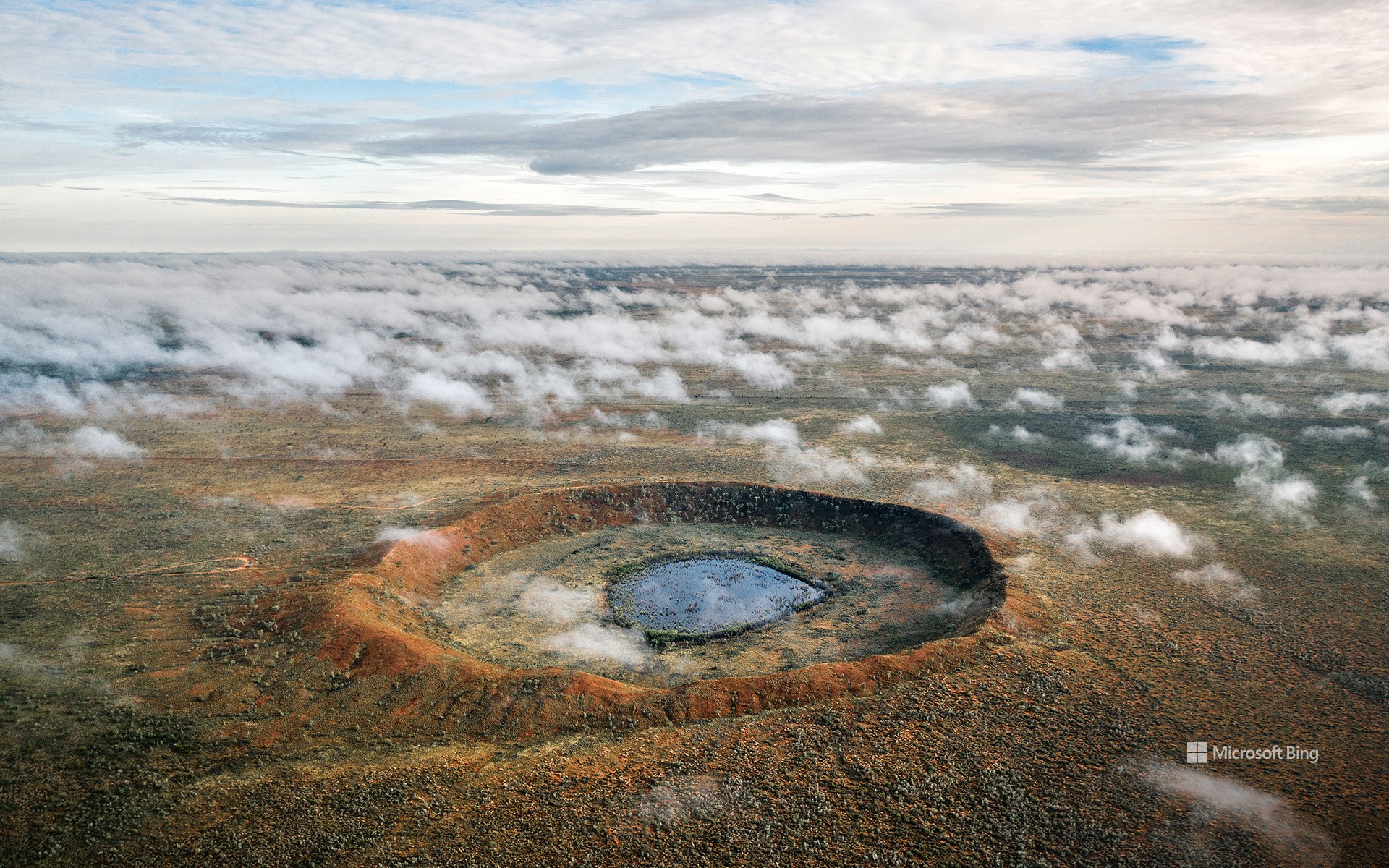
如今日图片所示,位于澳大利亚西部的沃尔夫溪陨石坑,由一颗估计重达14000多吨的陨石撞击地面而形成。该陨石坑直径约为2,871英尺,坐落于偏远的沃尔夫溪陨石坑国家公园之中。园区内平坦的沙漠草原与干旱平原衬托出陨石坑边缘的醒目轮廓。如今,游客可沿着陨石坑边缘徒步,亲身体验这一宇宙撞击留下的印记,同时了解它在科学研究和澳大利亚原住民文化中所具有的重要意义。
Asteroid Day
Each scar on Earth from a meteorite impact tells a story—from the asteroid that wiped out the dinosaurs to the lesser-known craters that dot the planet. Asteroid Day highlights ongoing research into asteroids and the potential threats they pose. Started in 2015 and backed by the United Nations, this day marks the anniversary of the Tunguska event—a massive explosion that occurred in Siberia on June 30, 1908. This explosion flattened over 800 square miles of Siberian forest near the Tunguska River. The blast released energy equal to 10–15 megatons of TNT, a standard measure of explosive force. Since then, craters like Arizona's Barringer, Quebec's Manicouagan, and others have helped scientists study what happens when space rocks hit Earth.
Wolfe Creek Crater in Western Australia, pictured here, was created by a meteorite estimated to have weighed over 14,000 tons. The crater is about 2,871 feet in diameter and sits within Wolfe Creek Meteorite Crater National Park, a remote protected area. The park's flat plains and desert grasslands make the crater's rim especially visible. Today, visitors can walk along the rim and learn about its significance to both science and local Indigenous communities.
马头岩上空的银河, 新南威尔士州, 澳大利亚 The Milky Way over Horse Head Rock, New South Wales, Australia (© Philip Thurston/Getty Images)
马头岩上空的银河, 新南威尔士州, 澳大利亚 The Milky Way over Horse Head Rock, New South Wales, Australia (© Philip Thurston/Getty Images)
海岸线附近的“马戏” Horsing around the coastline
马头岩,新南威尔士州,澳大利亚
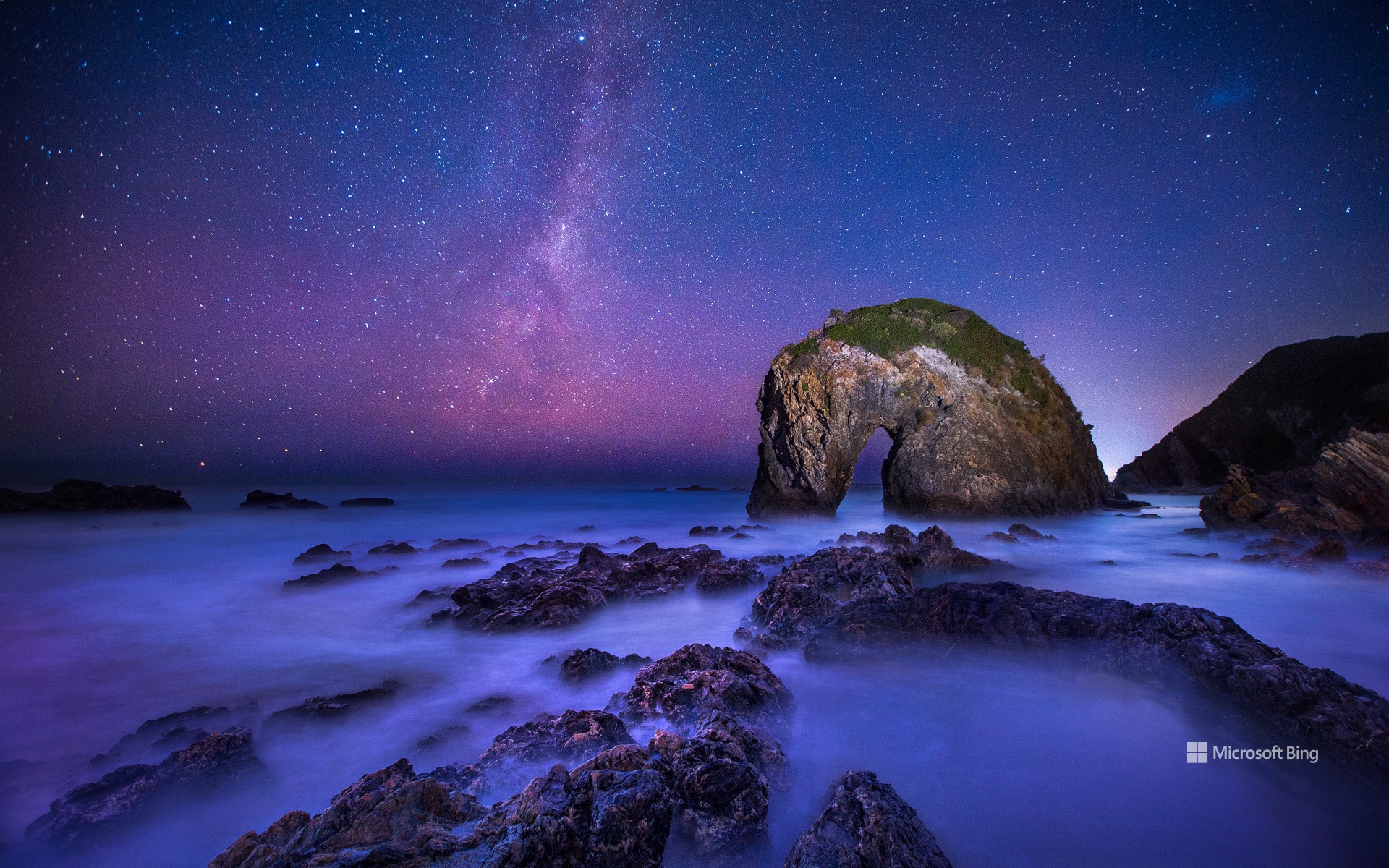
人们常说:“你可以牵马到水边,却无法强迫它饮水。”当然,马头岩除外。这块岩石屹立于澳大利亚新南威尔士州伯马吉附近的蓝宝石海岸。如今日图片所示,这块古老的岩石宛如大自然亲手雕刻的一匹神话中的骏马,永远在低头畅饮海水。据估计,马头岩已有5亿年历史,其酷似一匹弯颈饮水的马,这正是风蚀与海浪侵蚀共同作用的结果。作为该地区最古老且最具象征意义的地质地标之一,马头岩全年吸引着徒步旅行者、摄影师与自然爱好者前来观赏。最佳观景点位于骆驼岩与穆鲁纳角之间的高地步道,而更富冒险精神的访客则可在退潮时,从骆驼岩冲浪海滩绕行至此。
伯马吉位于悉尼以南约240英里处,坐落于古拉加山(又称单峰骆驼山)脚下。古拉加山是澳大利亚原住民尤因族的圣山,被尊称为“母亲山”。这一地区还拥有众多自然景观,包括骆驼岩、瓦拉加湖、伯马吉蓝池以及含羞草岩国家公园。此外,这里也是野生动物栖息和迁徙的重要区域,探索海岸线时,不妨留心观察正在迁徙的鲸鱼、嬉戏的海豚与翱翔的海鹰。
Horse Head Rock, New South Wales, Australia
You can lead a horse to water, but you can't make it drink—unless, of course, you're talking about Horse Head Rock, perched off the Sapphire Coast near Bermagui in New South Wales, Australia. This ancient formation, pictured here, seems as if nature itself has sculpted a mythical creature forever poised to drink from the sea. Estimated to be 500 million years old, the rock's uncanny resemblance to a horse bending its neck is the result of wind and wave erosion. As one of the region's oldest and most iconic landmarks, it attracts hikers, photographers, and nature lovers year-round. The best views are from the elevated track between Camel Rock and Murunna Point, while the more daring can scramble around from Camel Rock Surf Beach, though only safely at low tide.
Bermagui, about 240 miles south of Sydney, sits under Gulaga, also known as Mount Dromedary. Gulaga is a sacred mountain for the Yuin peoples, an Australian Aboriginal group, who call it Mother Mountain. This area is also home to other highlights, like Camel Rock, Wallaga Lake, the Bermagui Blue Pool, or Mimosa Rocks National Park. Wildlife is abundant too—keep an eye out for migrating whales, playful dolphins, and soaring sea eagles as you explore the coastline.
梦娜维尔岩池,悉尼,澳大利亚 Mona Vale Rockpool, Sydney, Australia (© jamenpercy/Getty Images)
梦娜维尔岩池,悉尼,澳大利亚 Mona Vale Rockpool, Sydney, Australia (© jamenpercy/Getty Images)
一处海滨奇观 A shore thing
梦娜威尔岩池,悉尼,澳大利亚
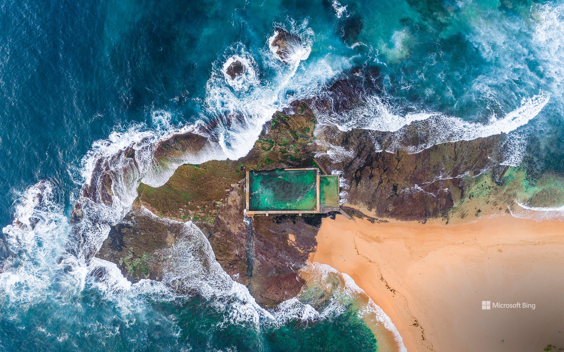
若你曾向往在海洋中畅游,却又不愿吞入口中的咸水,那么澳大利亚悉尼的梦娜威尔岩池无疑是一处理想选择。该泳池可谓水域中的一处悖论:池外波涛汹涌,而池内则水面平静、适宜游泳。岩池位于贝森海滩与梦娜威尔海滩之间,其形态更近似天然奇观而非典型人造泳池。这座泳池建于20世纪30年代的大萧条时期,作为失业救济工程的一部分,由工人于天然岩架上凿建而成。历经多次改建与升级,如今该泳池长度达30米,旁侧还设有一座较小的儿童泳池。二战期间,大批驻扎于附近的士兵也常前来此地游泳。泳池全年免费开放,定期由市政工作人员与潮汐共同清洁。因此,若你计划造访悉尼,不妨亲身体验这一海浪与池壁交汇之处,感受别具一格的海滨魅力。
Mona Vale Rockpool, Sydney, Australia
Ever wanted to swim in the ocean without accidentally drinking half of it? Enter Mona Vale Rockpool in Sydney, Australia—a watery paradox where the ocean is wild beyond the walls and well-behaved within its calm, contained edges. Perched in Sydney's Northern Beaches area—this rock pool feels more like a natural wonder than a human-made one. Built in the 1930s during the Depression, it was carved out of a natural rock shelf as part of an unemployment relief scheme. Upgraded over time, the pool is nearly 100 feet long and flanked by a smaller children's pool. The pools are free, open year-round, and cleaned regularly by both council crews and the ocean itself. So next time you are in Sydney, make a splash where the waves meet the wall. It's a shore thing.
悉尼港鸟瞰图,新南威尔士州,澳大利亚 Aerial view of Sydney Harbour, New South Wales, Australia (© jamenpercy/Getty Images)
悉尼港鸟瞰图,新南威尔士州,澳大利亚 Aerial view of Sydney Harbour, New South Wales, Australia (© jamenpercy/Getty Images)
尽享美景 Harboring nice views
克逊港,新南威尔士州,澳大利亚
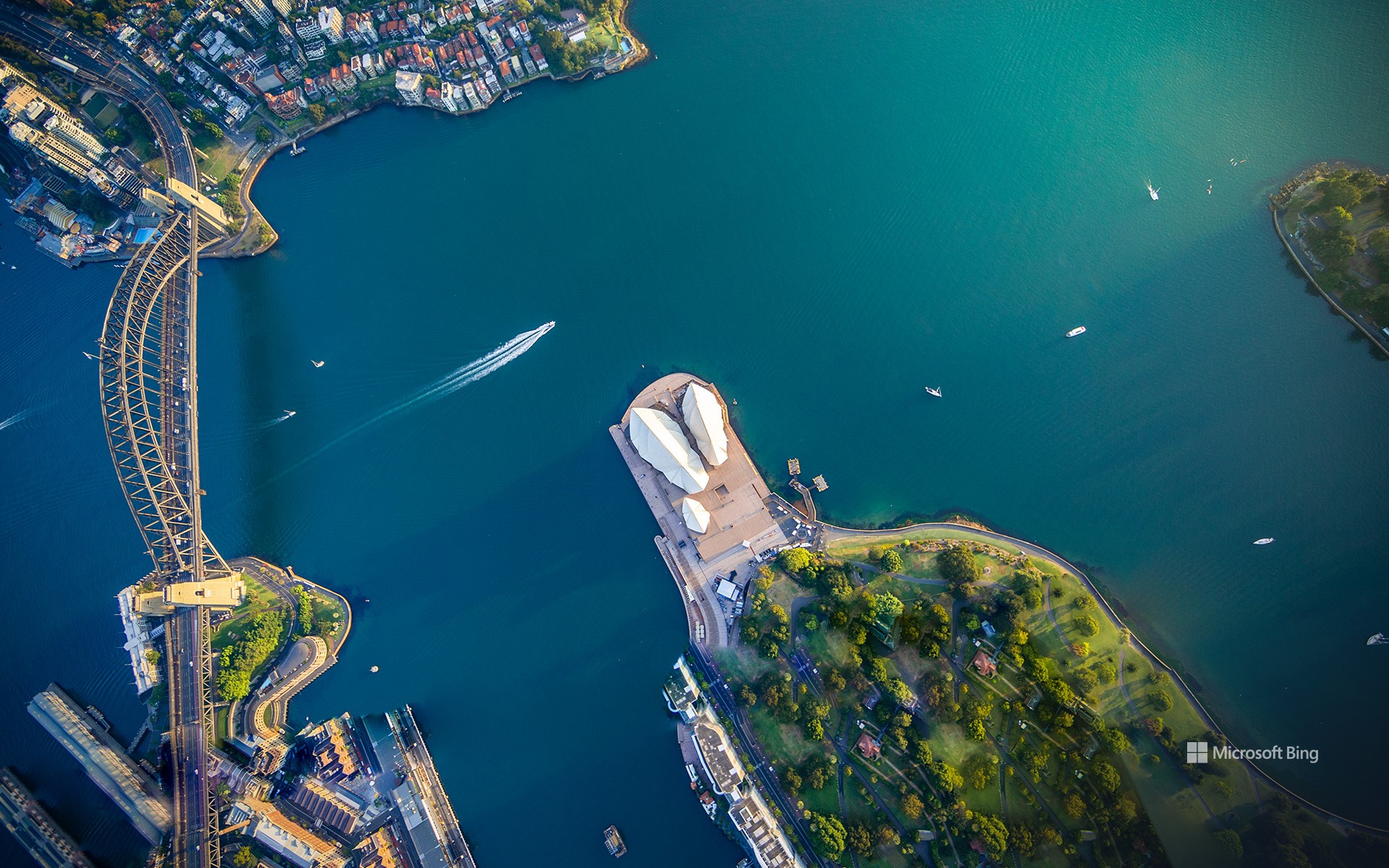
今日图片展示了悉尼的著名景点,波光粼粼的海面映衬着世界级地标:杰克逊港,也就是人们更熟知的悉尼港。在图片右侧,可以俯瞰到悉尼歌剧院,这座建筑杰作以白色帆状外壳闻名,在澳大利亚的阳光下熠熠生辉作为联合国教科文组织世界遗产,该建筑由丹麦建筑师约恩·乌松 设计,耗时 14 年建成。如今,它每年举办超过 1500 场演出,是全球最知名的文化艺术中心之一。图片左侧,横跨港湾的是悉尼海港大桥,因其拱形钢架结构而被亲切地称为“衣架”,连接着悉尼的南北两岸。这座桥1932 年开通时,是世界上最宽的长跨度桥梁。喜欢冒险的游客还可以攀登桥顶,到达 440 英尺的高度,俯瞰令人惊叹的悉尼全景。
每年新年前夜,悉尼港都会变身为世界级烟花秀的舞台,吸引超过百万名现场观众,以及全球数百万电视观众共同观看这场盛大的视觉盛宴。烟花从大桥和港口上的驳船一同点燃,成为无数人的人生必体验清单之一。无论何时来到悉尼港,这里都能为游客带来融合历史、冒险与自然之美的非凡体验。
Sydney Harbour, New South Wales, Australia
Today's photo features a spot in Sydney, Australia, where shimmery waters meet famous landmarks: Port Jackson, more commonly known as Sydney Harbour. In the center, we have a bird's-eye view of the Sydney Opera House, an architectural icon with sail-like shells that shine bright under the Australian sun. Designed by Danish architect Jørn Utzon, this UNESCO World Heritage Site took 14 years to complete and hosts over 1,500 performances annually. Just across the harbor, on the left side of the picture, the Sydney Harbour Bridge—affectionately called 'the Coathanger' for its arching steel frame—connects the city's northern and southern shores. When it opened in 1932, it was the world's widest long-span bridge. Adventurous visitors can climb its 440-foot summit for breathtaking panoramic views.
Every New Year's Eve, this waterfront transforms into the stage for spectacular fireworks displays, attracting over a million spectators and millions more watching worldwide. The dazzling show, launched from the bridge and barges across the harbor, is a bucket-list experience. No matter what time of year, Sydney Harbour promises an experience filled with history, adventure, and beauty at every turn.
桉树,梅加龙谷,蓝山山脉国家公园,新南威尔士州,澳大利亚 Eucalyptus trees, Megalong Valley, Blue Mountains National Park, NSW, Australia (© Andrew Peacock/TANDEM Stills + Motion)
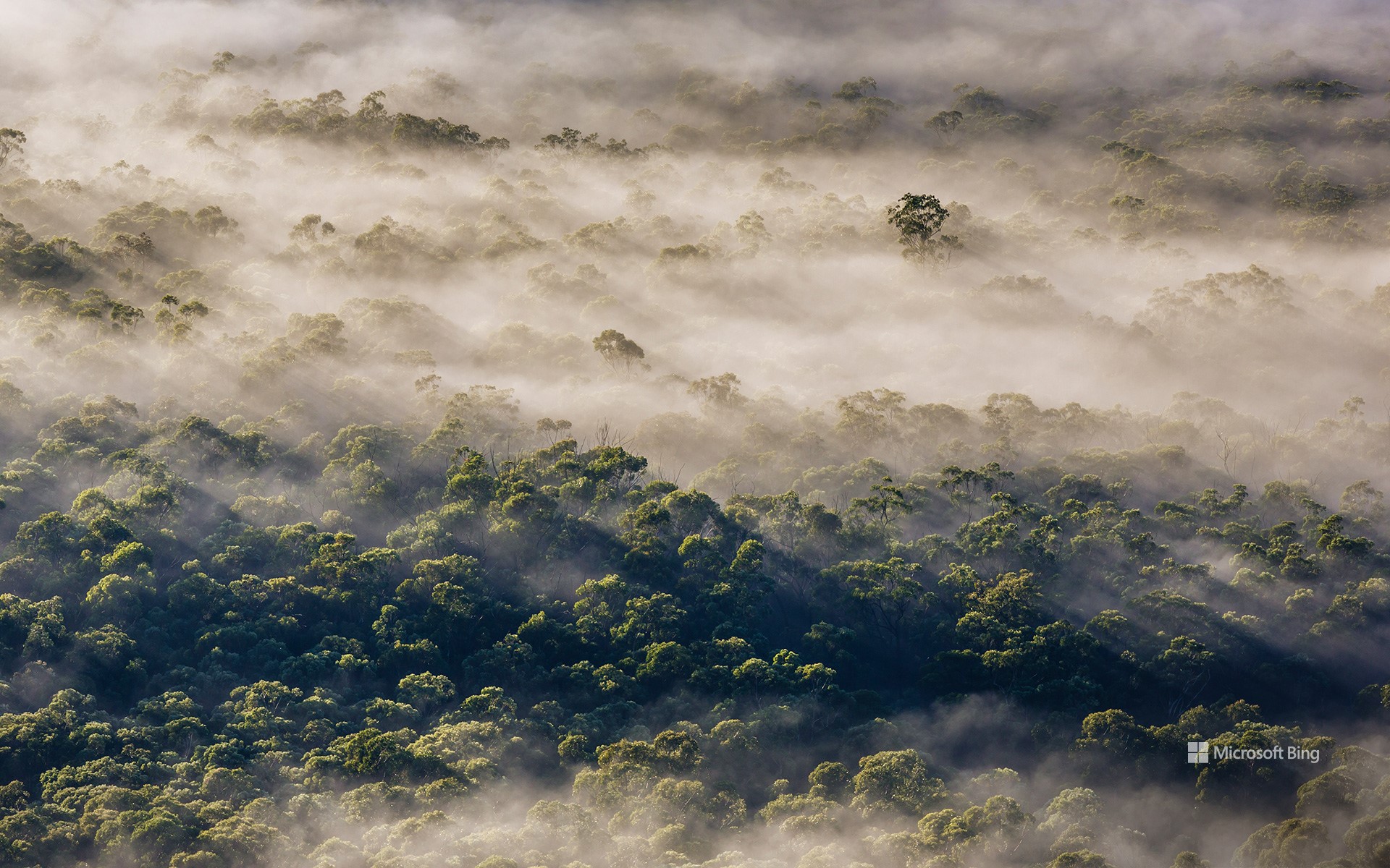
桉树,梅加龙谷,蓝山山脉国家公园,新南威尔士州,澳大利亚 Eucalyptus trees, Megalong Valley, Blue Mountains National Park, NSW, Australia (© Andrew Peacock/TANDEM Stills + Motion)
桉树奇景 A eucalyp-tastic view
梅加龙谷,蓝山国家公园,新南威尔士州,澳大利亚
今天,我们来到澳大利亚新南威尔士州的蓝山国家公园。这里以壮观的悬崖、茂密的雨林和飞泻的瀑布闻名,是联合国教科文组织列为世界遗产的自然瑰宝,拥有丰富的生物多样性。蓝山地区最标志性的景观之一就是今日图片中展示的桉树。这里生长着 92 种桉树,游客可以近距离欣赏这些生命力顽强的树木,它们构成了澳大利亚野生生态系统的核心。桉树芳香的叶子是考拉的主要食物来源,而桉树的树皮和茂密的树冠则为无数鸟类和昆虫提供了栖息地。隐藏在山脉之间的还有梅加隆谷,这片宁静的世外桃源距离悉尼仅两小时车程,坐拥度假木屋、酒庄以及备受喜爱的梅加隆谷茶室。在这里,可以品尝新鲜出炉的司康饼,搭配当地果酱,享受惬意时光。此外,还可以探索六英尺步道,这条历史悠久的小径最早建于19世纪,最初是为骑马者开辟的通道。蓝山国家公园为游客带来一场深入澳大利亚原始自然之美的难忘旅程。
Megalong Valley, Blue Mountains National Park, Australia
Today, we are in New South Wales, Australia, amid the Blue Mountains National Park. Known for its dramatic cliffs, dense rainforests, and cascading waterfalls, this UNESCO World Heritage Site is a treasure trove of natural beauty and biodiversity. Among the most iconic features of the Blue Mountains region are the eucalyptus trees, pictured here. Home to 92 species of eucalyptus, this area offers visitors a chance to marvel at these resilient trees, which are central to Australian wildlife. Their aromatic leaves provide food for koalas, while their bark and canopy create habitats for countless birds and insects.
Also nestled within the mountains is the Megalong Valley. Just a 2-hour drive from Sydney, this region is home to getaway cabins, wineries, and the Megalong Valley Tearooms, a charming retreat where you can enjoy freshly baked scones paired with local jams. Here, you can also explore the Six Foot Track, a historic trail originally carved in the 19th century for horseback riders. The Blue Mountains promise an unforgettable escape into the heart of Australia's wild beauty.
泰瑞尔湖,维多利亚州,澳大利亚 Lake Tyrrell, Victoria, Australia (© Monica Bertolazzi/Getty Images)
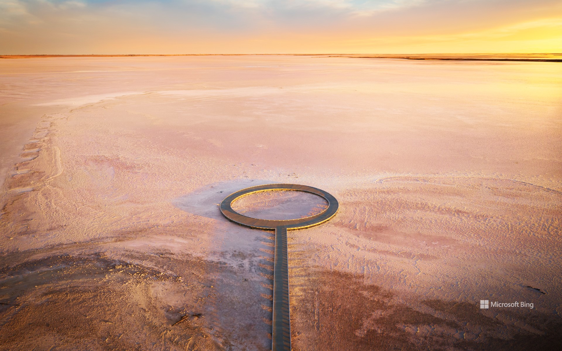
泰瑞尔湖,维多利亚州,澳大利亚 Lake Tyrrell, Victoria, Australia (© Monica Bertolazzi/Getty Images)
大地之盐 Salt of the earth
泰瑞尔湖,维多利亚州,澳大利亚
澳大利亚南部的泰瑞尔湖,是天空与大地交汇之地,形成了令人炫目的奇景。泰瑞尔湖是维多利亚州最大的盐湖,形成于约12万年前。随着气候变化,湖泊水位逐渐下降,如今大部分时间干涸,仅在冬季覆盖约2英寸的水层。“泰瑞尔”这个名字源自当地沃加亚语中的“天空”,致敬了博罗恩原住民对天文学的浓厚兴趣。泰瑞尔湖面积超过70平方英里,是野生动物的天堂,栖息着马利地区的爬行动物、袋鼠和鸸鹋。
近年来,泰瑞尔湖已成为热门旅游景点。每年冬季,世界各地的游客慕名前来,湖面如镜,映照无垠的澳大利亚天空,是理想的拍照胜地。湖底盐层的独特景观也为摄影增添了绝佳背景。每到夜晚,这里成为观星胜地,人们在此仰望南半球的星座,感叹夜空的壮丽。
Lake Tyrrell, Victoria, Australia
At Lake Tyrrell, in southern Australia, the sky meets the Earth in a dazzling display. The state of Victoria's largest salt lake was formed around 120,000 years ago. Over time, climate changes caused water levels to drop; these days, the lake is normally dry, except in winter when it's covered in about 2 inches of water. The name 'Tyrrell' comes from the local Wergaia word for 'sky,' a nod to the Boorong Aboriginal People's interest in astronomy. Spanning more than 70 square miles, Lake Tyrrell is a haven for wildlife, including kangaroos, emus, and various reptiles.
In recent years, the lake has become a tourist hotspot. People come from all over the world during the winter months, drawn by its mirror-like surface that reflects the endless Australian sky, making it the perfect photo op. Salt formations on the lakebed also provide a stunning backdrop for photographs. At night, it becomes the perfect place for stargazing, offering the chance to marvel at the constellations of the Southern Hemisphere.
塔斯曼拱门,塔斯马尼亚州,澳大利亚 Tasmans Arch, Tasmania, Australia (© Gary Bell/Minden Pictures)
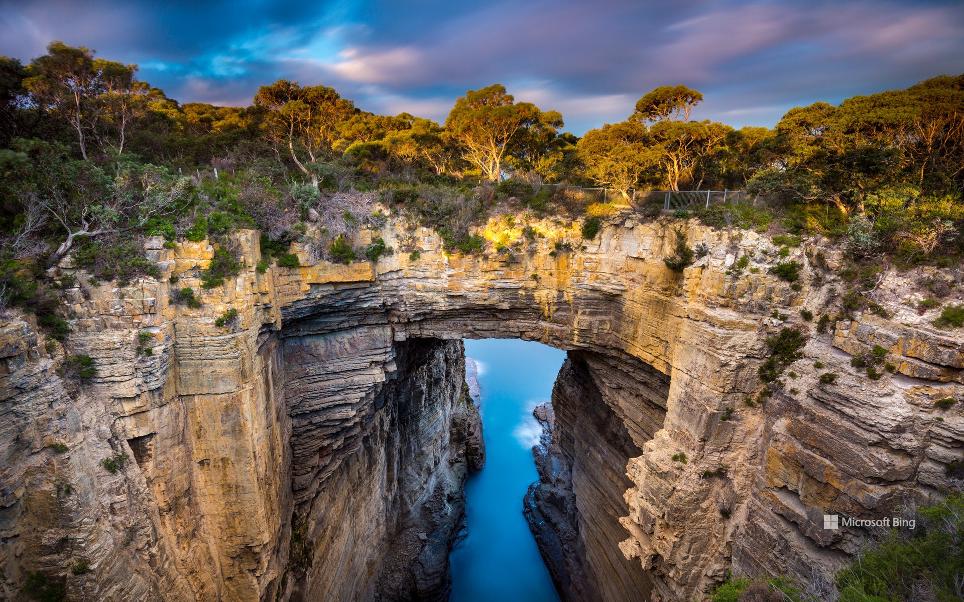
塔斯曼拱门,塔斯马尼亚州,澳大利亚 Tasmans Arch, Tasmania, Australia (© Gary Bell/Minden Pictures)
令人震撼的拱门 An arch that rocks
塔斯曼拱门,塔斯曼国家公园,塔斯马尼亚州,澳大利亚
准备好进行一次海岸探险了吗?欢迎来到位于塔斯马尼亚州的塔斯曼国家公园!塔斯马尼亚州是澳大利亚的一个岛州,距离大陆东南海岸约150英里。塔斯曼国家公园占地面积超过41平方英里,涵盖森林半岛和塔斯曼半岛的部分地区,包含整个塔斯曼岛。该公园是几种独特的开花植物以及澳大利亚海狗和小蓝企鹅的家园。壮观的悬崖和独特的辉绿岩柱是这一地区的主要特征。今天的图片中的塔斯曼拱门就是一个典型的例子。它曾是一个巨大的海蚀洞的洞顶。海水的压力加上空气、沙子和石头,慢慢撬开了悬崖上的垂直裂缝,使大块的岩石脱落。洞穴不断扩大、加深、加长,直到最后崩塌,留下了这座高耸的天然桥梁。塔斯曼拱门以荷兰探险家阿贝尔·塔斯曼的名字命名,塔斯马尼亚州也以他的名字命名。
Tasmans Arch, Tasmania, Australia
Ready for a coastal adventure? Welcome to Tasman National Park in Tasmania, an island state of Australia about 150 miles off its southeastern coast. Spanning more than 41 square miles, this park features dramatic cliffs and distinctive columns of dolerite rock. Tasmans Arch, seen in today's image, is a standout example. Shaped over time by the Tasman Sea, it was once the roof of a massive sea cave. The sea's pressure, combined with air, sand, and stones, slowly pried open the vertical cracks in the cliff, dislodging chunks of rock. The cave kept growing, deepening, and lengthening, until it eventually gave way, leaving behind this towering natural bridge. Tasmans Arch is named after the Dutch explorer Abel Tasman, who also lends his name to the state of Tasmania.