斯奈费尔斯山,里奇韦附近的圣胡安山脉,科罗拉多州,美国 Mount Sneffels in the San Juan Mountains near Ridgway, Colorado, USA (© lightphoto/Getty Images)
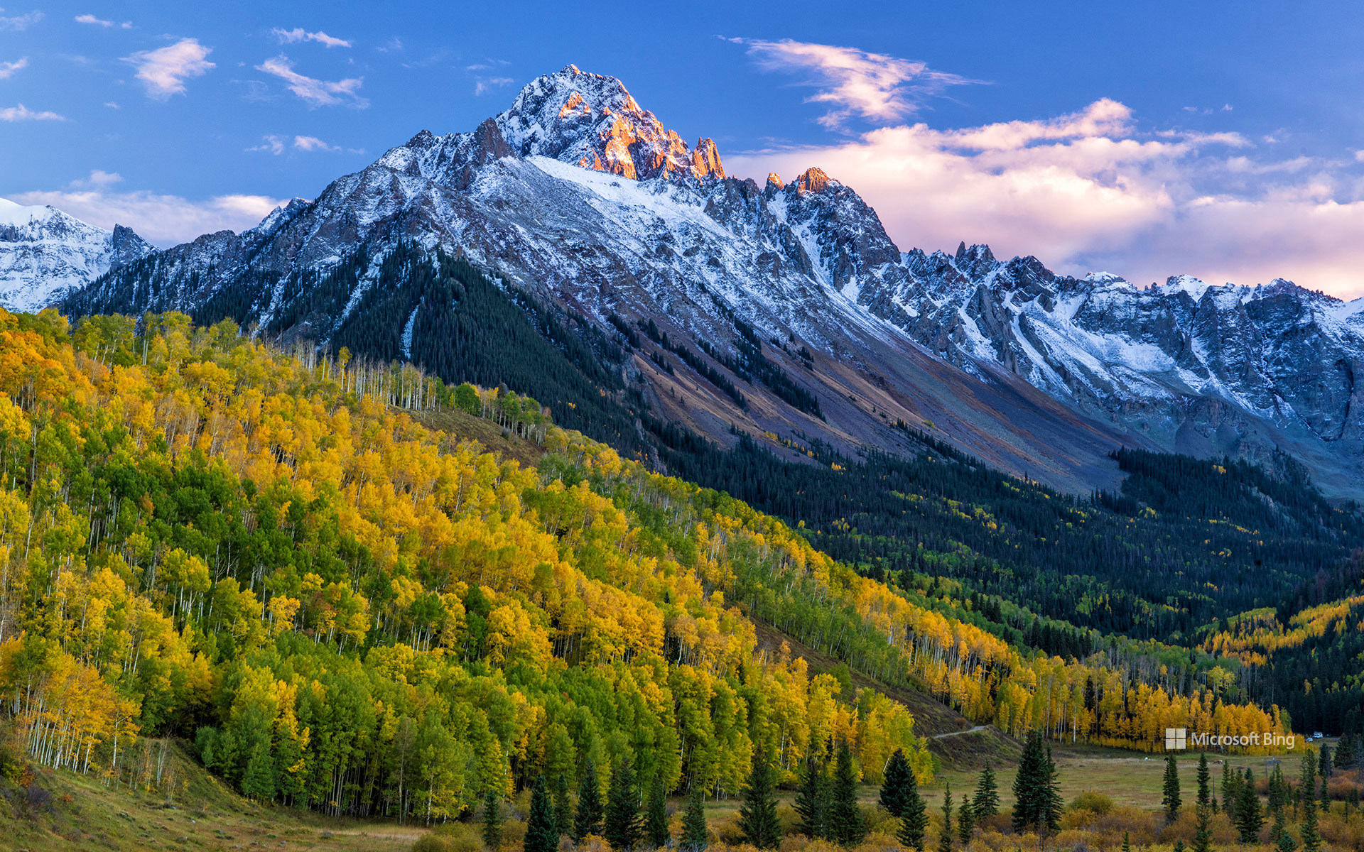
斯奈费尔斯山,里奇韦附近的圣胡安山脉,科罗拉多州,美国 Mount Sneffels in the San Juan Mountains near Ridgway, Colorado, USA (© lightphoto/Getty Images)
一窥科罗拉多群峰 'Peak' into Colorado
圣胡安山脉中的斯奈费尔斯山,科罗拉多州
有些山会让你付出一番努力才能欣赏到美景,而攀登斯奈费尔斯山,最考验人的则是最后几百英尺。它高耸于科罗拉多州的圣胡安山脉,海拔14,150英尺,是一座“十四峰”,在里奇韦、乌雷和特柳赖德一带十分醒目。它坐落在占地16,587英亩的斯奈费尔斯山荒野区内,这片保护区于1980年获指定。徒步者可以从多条路线登山,包括经扬基博伊盆地和蓝湖群地区的路线。
这座山本身在地质构造上独具特色:与附近许多山峰不同,斯奈费尔斯山主要由侵入较古老火山沉积层的火成岩体构成。山峰西侧下方,蓝湖群散布在一处深邃的高山盆地中,为人们体验这一地区提供了另一种方式。山峰还高出林线,那里的地貌明显更加开阔,岩石也更多。要留意天空,因为山区天气总爱上演意想不到的转折。请查看天气预报并尽早出发,同时携带保暖衣物、水和适合当时天气状况的装备。
Mount Sneffels in the San Juan Mountains near Ridgway, Colorado
Some mountains make you work for the view. Mount Sneffels makes you work for the last few hundred feet. Rising to 14,150 feet in Colorado's San Juan Mountains, this fourteener is a familiar sight around Ridgway, Ouray, and Telluride. It sits within the 16,587-acre Mount Sneffels Wilderness, a protected area designated in 1980. Hikers can reach the mountain from several approaches, including the Yankee Boy Basin and the Blue Lakes area.
The mountain itself is geologically distinctive: unlike many of its nearby peaks, Mount Sneffels is largely made of an intrusion of igneous rock that pushed into older volcanic deposits. Below its western flank, Blue Lakes fill a deep alpine basin and offer another way to experience the area. The peak also rises above the tree line, where the landscape becomes noticeably more exposed and rocky. Keep an eye on the sky because mountain weather loves a plot twist. Check the forecast and start early, and bring layers, water, and the right gear for the conditions.
格莱德溪磨坊,巴布科克州立公园,西弗吉尼亚州,美国 Glade Creek Grist Mill, Babcock State Park, West Virginia, USA (© dszc/Getty Images)
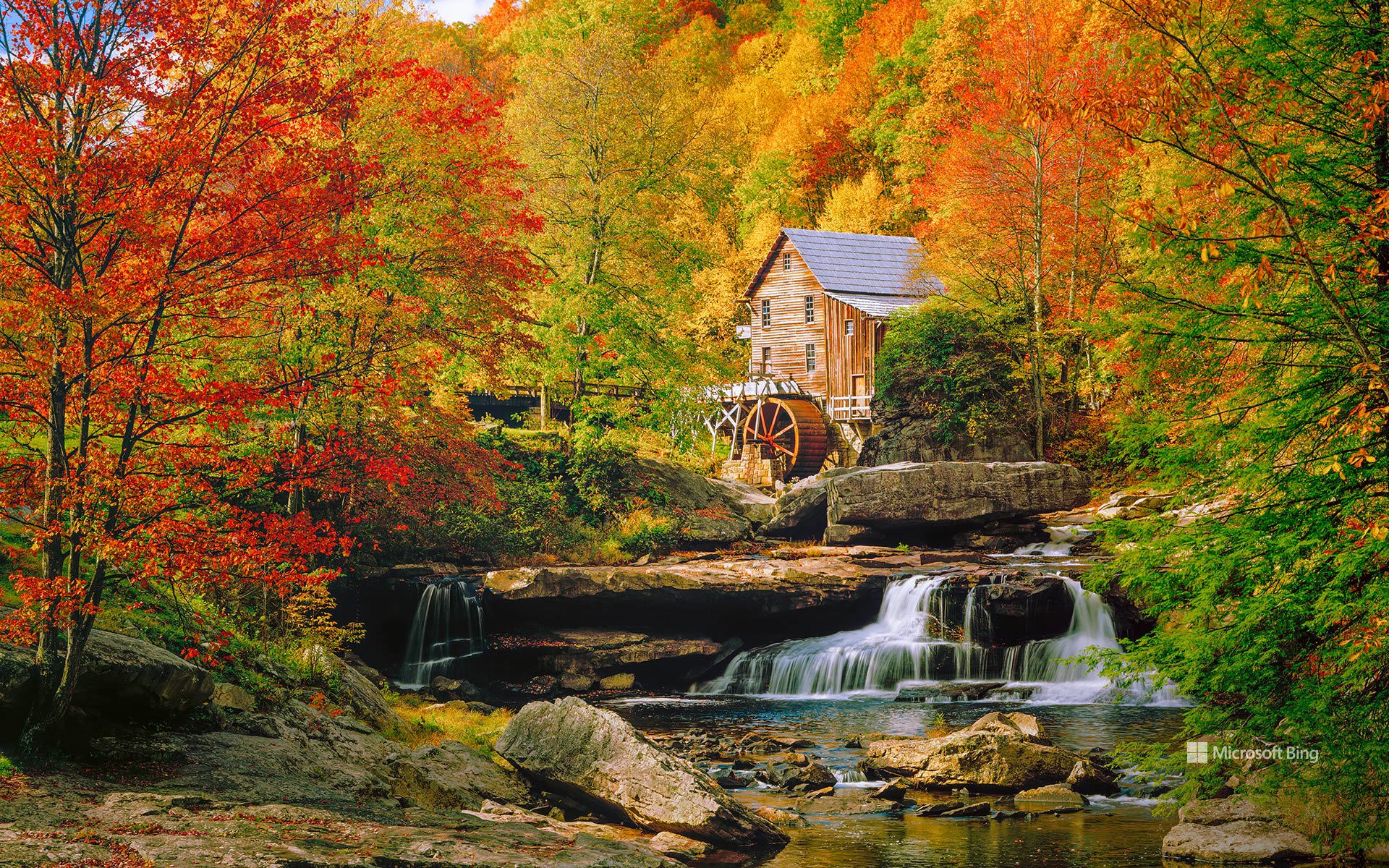
格莱德溪磨坊,巴布科克州立公园,西弗吉尼亚州,美国 Glade Creek Grist Mill, Babcock State Park, West Virginia, USA (© dszc/Getty Images)
秋色中转动的水轮 Where autumn turns the wheel
格莱德溪磨坊,巴布科克州立公园,美国
格莱德溪磨坊坐落在西弗吉尼亚州巴布科克州立公园内格莱德溪的岩石水域上方,周围红色、橙色和金色交错。尽管它看起来像是拓荒时代的遗迹,但这座磨坊实际上是为致敬阿巴拉契亚地区的磨坊传统而精心建造的。
这座磨坊于1976年建成,使用了从曾经散布在西弗吉尼亚州各地的数座历史悠久的谷物磨坊中抢救出来的部件,将该州乡村历史的片段汇聚在一座仍在运转的建筑中。格莱德溪的溪水至今仍推动水轮,并为传统谷物研磨演示提供动力,让游客得以一窥曾经遍及阿巴拉契亚山脉的一种生活方式。
这座磨坊或许是公园最具辨识度的地标,但它只是整个故事的一部分。每到秋季,巴布科克州立公园的森林便化作绚丽色彩的拼图,为瀑布、岩石遍布的溪床和绵延数英里的徒步小径勾勒出边框。这里的景观与磨坊共同构成了阿巴拉契亚历史、工艺和自然之美的恒久象征。
Glade Creek Grist Mill, Babcock State Park, West Virginia
Surrounded by a patchwork of red, orange, and gold, Glade Creek Grist Mill stands above the rocky waters of Glade Creek in West Virginia's Babcock State Park. Although it looks like a relic from the pioneer era, the mill is actually a carefully crafted tribute to Appalachia's milling heritage.
Completed in 1976, the mill was built using parts salvaged from several historic gristmills once scattered across West Virginia, bringing together pieces of the state's rural past in a single working structure. Water from Glade Creek still turns the wheel and powers traditional grain-grinding demonstrations, offering visitors a glimpse into a way of life once common throughout the Appalachian Mountains.
The mill may be the park's most recognizable landmark, but it is only part of the story. Each autumn, Babcock State Park's forests transform into a mosaic of brilliant color, framing waterfalls, rocky streambeds, and miles of hiking trails. Together, the landscape and mill create an enduring symbol of Appalachian history, craftsmanship, and natural beauty.
蒙特雷湾上空的双冠鸬鹚,加利福尼亚州,美国 Double-crested cormorants over Monterey Bay, California, USA (© Hiroya Minakuchi/Minden Pictures)
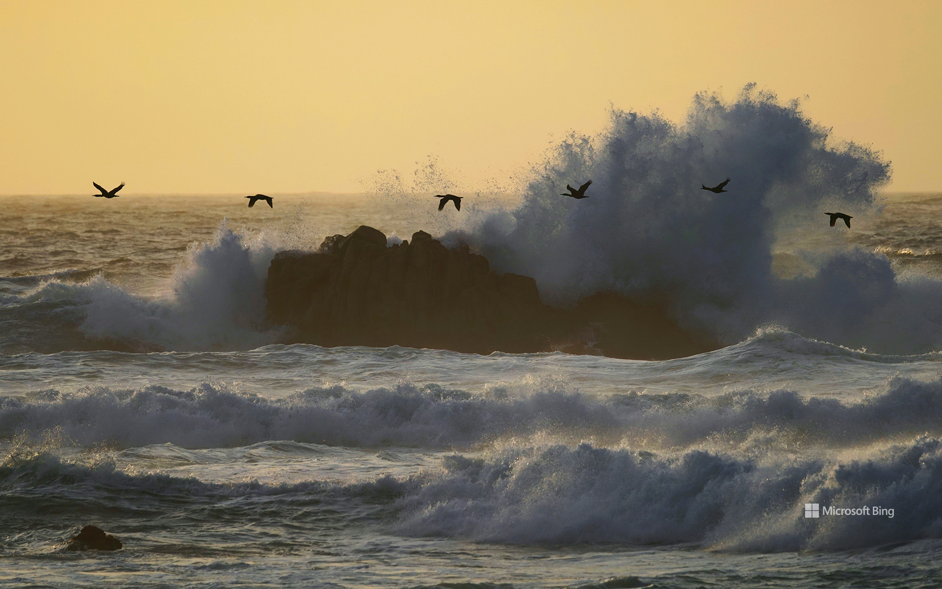
蒙特雷湾上空的双冠鸬鹚,加利福尼亚州,美国 Double-crested cormorants over Monterey Bay, California, USA (© Hiroya Minakuchi/Minden Pictures)
迁飞路线上的生命 Life along the flyway
世界候鸟日
世界候鸟日旨在庆祝大自然最壮观的旅程之一。这项全球性活动于每年5月和10月举行,反映世界各地的迁徙模式,并强调保护鸟类赖以生存的栖息地和迁飞路线的重要性。“每一只鸟都很重要——您的观察至关重要!”是2026年的主题,着重说明个人和社区的观察可以如何为鸟类研究、监测和保护贡献力量,帮助科学家更好地了解迁徙。
今天的图片捕捉到了双冠鸬鹚飞越加利福尼亚州蒙特雷湾海浪上空的景象。这些适应力强的海鸟广泛分布于北美洲,可能迁徙,也可能全年留在原地,具体取决于种群。沿着加利福尼亚州海岸,海湾、湿地和河口为沿太平洋迁飞路线飞行的鸟类提供了重要栖息地。对许多物种而言,这些生态系统为跨越漫长距离的旅程提供支持。每一次目击都有助于揭示这些迁徙,并提醒我们,即使只是一只鸟,也可能是一个宏大得多的故事的一部分。
World Migratory Bird Day
World Migratory Bird Day celebrates one of nature's greatest journeys. Observed each year in May and October, the global campaign reflects migration patterns around the world and highlights the importance of protecting the habitats and flyways that birds depend on. 'Every Bird Counts—Your Observations Matter!' is the 2026 theme, emphasizing how observations by individuals and communities can contribute to bird research, monitoring, and conservation, helping scientists better understand migration.
Today's image captures double-crested cormorants flying above the waves of Monterey Bay, California. Widespread across North America, these adaptable seabirds may migrate or remain year-round, depending on the population. Along California's coast, bays, wetlands, and estuaries provide important habitat for birds traveling the Pacific Flyway. For many species, these ecosystems support journeys spanning vast distances. Each sighting helps reveal these migrations and reminds us that even a single bird can be part of a much larger story.
查图加河,阿巴拉契亚山脉,北卡罗来纳州,美国 Chattooga River in the Appalachian Mountains, North Carolina, USA (© mtilghma/Getty Images)
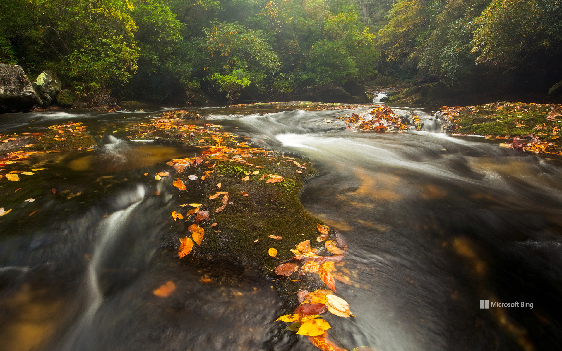
查图加河,阿巴拉契亚山脉,北卡罗来纳州,美国 Chattooga River in the Appalachian Mountains, North Carolina, USA (© mtilghma/Getty Images)
一条值得保护的河流 A river worth protecting
查图加河,美国
长期以来,河流在美国各地的生活中发挥着重要作用,为社区、野生动物和工业提供支持。1968年10月2日,林登·B·约翰逊总统签署《野生与风景河流法》,使其成为法律。该法建立了一个国家体系,用于保护具有卓越景观、休闲、地质、鱼类和野生动物、历史或文化价值的河流及河段。该法使指定河流保持自由流动状态,保护其水质,并旨在守护使它们值得获此指定的特质。
今天的图片展示了查图加河。1974年,该河被纳入这一体系,横跨佐治亚州、北卡罗来纳州和南卡罗来纳州的近57英里河段获指定。查图加河流经阿巴拉契亚山脉,以其风景、激流休闲活动和野生动物而闻名。查图加河常被称为美国东南部的皇冠明珠,可供人们开展漂流、皮划艇和独木舟运动。它甚至还是詹姆斯·迪基1970年小说《Deliverance》中虚构的卡胡拉瓦西河的原型。
Wild and Scenic Rivers Act
Rivers have long played an important role in life across the United States, supporting communities, wildlife, and industry. President Lyndon B. Johnson signed the Wild and Scenic Rivers Act into law on October 2, 1968. It created a national system to protect rivers and river segments with outstanding scenic, recreational, geologic, fish and wildlife, historic, or cultural values. The Act preserves designated rivers in a free-flowing condition, protects their water quality, and aims to safeguard the qualities that made them worthy of designation.
Featured in today's image, the Chattooga River became part of the system in 1974, with nearly 57 miles designated across Georgia, North Carolina, and South Carolina. Flowing through the Appalachian Mountains, the river is known for its scenery, whitewater recreation, and wildlife. Often called the crown jewel of the Southeast, the Chattooga offers opportunities for rafting, kayaking, and canoeing. It even served as the model for the fictional Cahulawassee River in James Dickey's 1970 novel 'Deliverance.'
奥姆斯特德观景点的日落,优胜美地国家公园,加利福尼亚州,美国 Sunset from Olmsted Point, Yosemite National Park, California, USA (© Robb Hirsch/Tandem Stills + Motion)
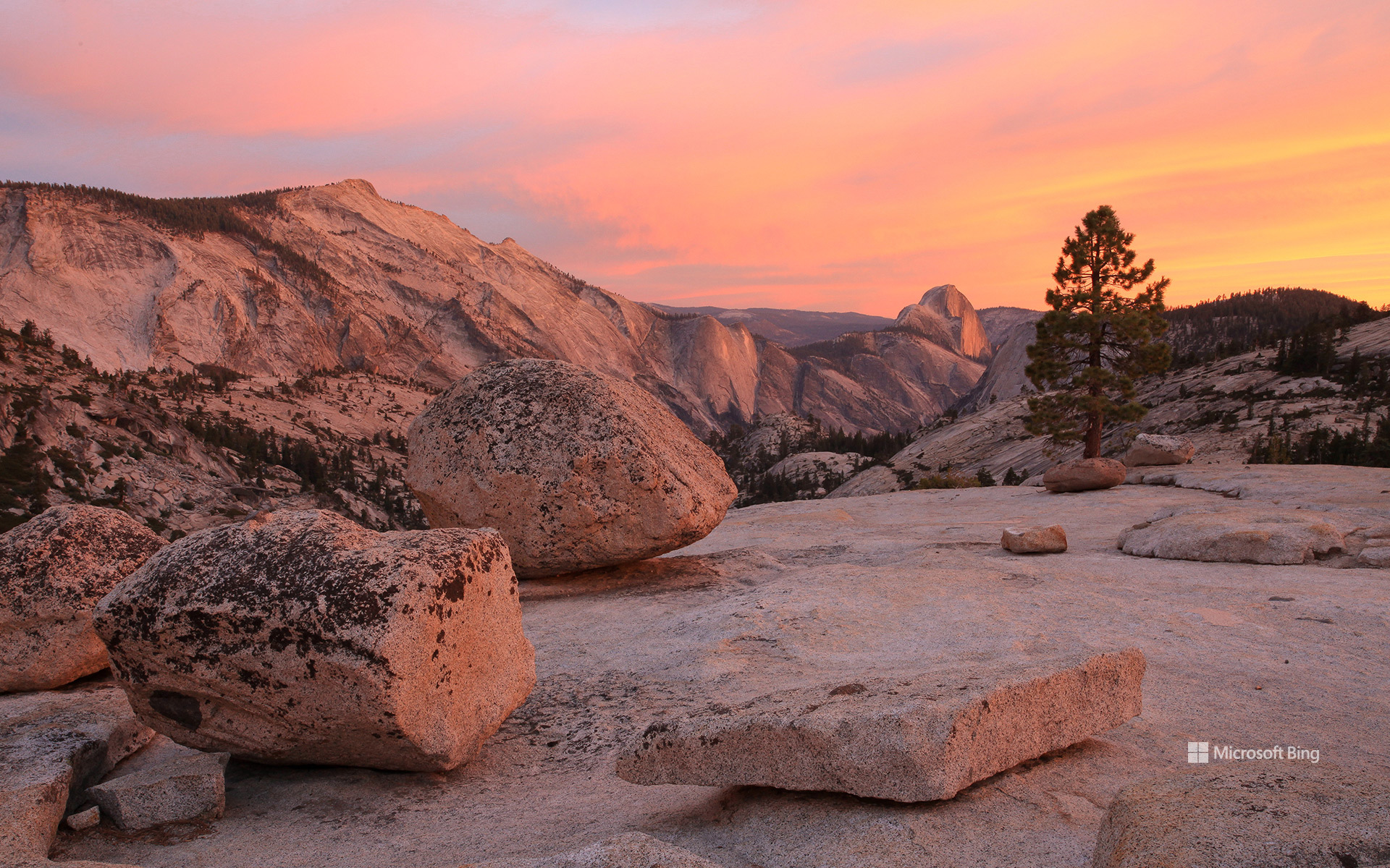
奥姆斯特德观景点的日落,优胜美地国家公园,加利福尼亚州,美国 Sunset from Olmsted Point, Yosemite National Park, California, USA (© Robb Hirsch/Tandem Stills + Motion)
在花岗岩中读懂时间 Reading time in granite
优胜美地国家公园纪念日
从这里望去,优胜美地一些最著名的地标也呈现出截然不同的一面。通常所见的半穹顶从优胜美地山谷上方拔地而起,而在这里,它露出陡峭的北壁,让这个熟悉的标志性景观看起来几乎令人感到陌生。远处还有特纳亚峡谷、云歇峰、特纳亚湖,以及记录着数百万年隆升、侵蚀与冰川作用的浅色岩石。奥姆斯特德观景点得名于景观设计师弗雷德里克·劳·奥姆斯特德及其子小弗雷德里克·劳·奥姆斯特德;父子二人的自然保护工作推动了美国国家公园运动的发展。这里提醒着人们:优胜美地不仅景色壮美,还是一片仍在以岩石讲述自身故事的土地。
Yosemite National Park anniversary
On October 1, 1890, Yosemite became the nation's third national park. More than a century later, it still feels like a place that operates on geological time rather than human schedules. From Olmsted Point, the overlook in today's image, that timescale is impossible to miss. The smooth granite underfoot was sculpted by glaciers, while scattered boulders known as glacial erratics were carried here by ice and abandoned when it melted.
The view also turns some of Yosemite's most famous landmarks inside out. Half Dome, usually seen rising above Yosemite Valley, reveals its sheer north face from here, making the familiar icon look almost unfamiliar. Beyond it lie Tenaya Canyon, Clouds Rest, Tenaya Lake, and pale stone that records millions of years of uplift, erosion, and ice. Named for landscape architect Frederick Law Olmsted and his son, Frederick Law Olmsted Jr., whose conservation work helped shape America's park movement, Olmsted Point offers a reminder that Yosemite is not just scenic; it is a landscape still telling its story in stone.
卡西洛夫河冰川融水滋养的湛蓝河水,阿拉斯加州,美国 The blue, glacier-fed waters of the Kasilof River, Alaska, USA (© jared lloyd/Getty Images)
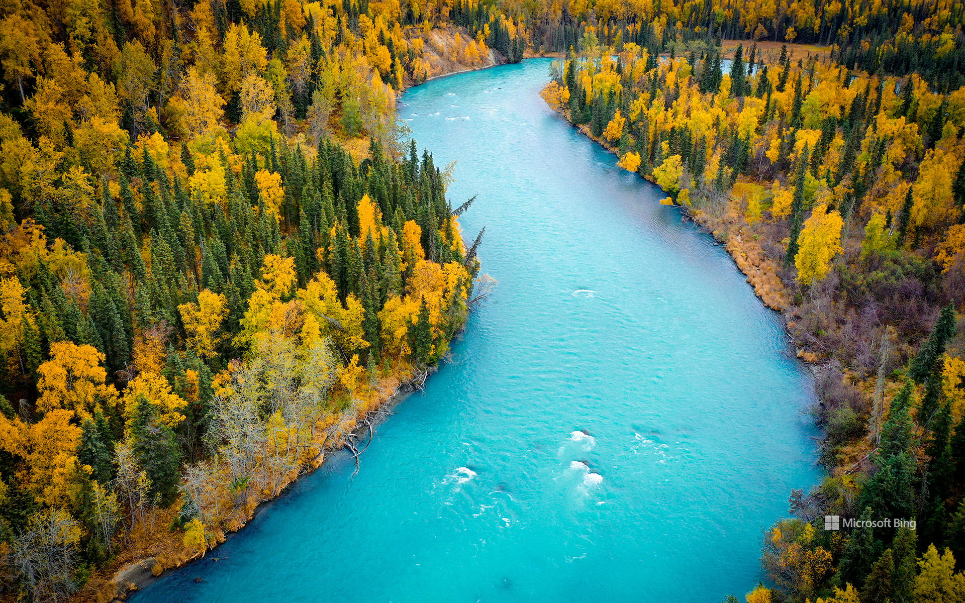
卡西洛夫河冰川融水滋养的湛蓝河水,阿拉斯加州,美国 The blue, glacier-fed waters of the Kasilof River, Alaska, USA (© jared lloyd/Getty Images)
冰川孕育之河 Born of glaciers
阿拉斯加州卡西洛夫河由冰川补给的蓝色河水
从空中俯瞰,卡西洛夫河宛如一条绿松石色的丝带,蜿蜒穿过阿拉斯加州的基奈半岛。鲜艳的蓝色河水源于从图斯图梅纳湖向下游输送的冰川粉砂;该湖是阿拉斯加州最大的淡水湖之一。河流全长约17英里,最终注入库克湾。它虽比著名的邻河基奈河短,却同样不同凡响。
卡西洛夫河发源于冰塑地貌,与当地的渔业文化始终密不可分。长期以来,这条河一直是德纳伊纳人的重要资源,后来又成为商业捕捞、生计捕捞和休闲垂钓的重地。如今,垂钓者为洄游的鲑鱼而来,游客则可探索附近的休闲场所、露营地和自然步道。卡西洛夫社区本身是半岛西海岸的一座小渔镇;这里的河流、森林和河口栖息地滋养着丰富的野生动物。无论从漂流艇上还是空中观赏,卡西洛夫河都能让人鲜明地窥见阿拉斯加的冰川起源,以及这片土地与水之间绵延不绝的联系。
The blue, glacier-fed waters of the Kasilof River, Alaska
Seen from above, the Kasilof River winds like a ribbon of turquoise through Alaska's Kenai Peninsula. The vivid blue water comes from glacial silt carried downstream from Tustumena Lake, one of the largest freshwater lakes in the state. Flowing about 17 miles before emptying into Cook Inlet, the river is shorter than its famous neighbor, the Kenai, but no less remarkable.
The Kasilof begins in a landscape shaped by ice and remains closely tied to the region's fishing culture. Long an important resource for the Dena'ina people, the river later became central to commercial, subsistence, and recreational fishing. Today, anglers come for salmon runs, while visitors explore nearby recreation sites, campgrounds, and nature trails. The community of Kasilof itself is a small fishing town on the peninsula's west coast, where river, forest, and estuary habitats support abundant wildlife. Whether viewed from a drift boat or from the air, the Kasilof offers a striking glimpse of Alaska's glacial origins and enduring connection to the water.
熊耳国家纪念区附近的雪松台地和骡子角,犹他州,美国 Cedar Mesa and Muley Point near Bears Ears National Monument, Utah, USA (© Jeff Clay/Tandem Stills + Motion)
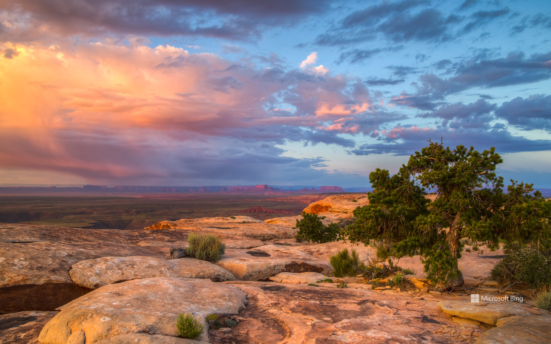
熊耳国家纪念区附近的雪松台地和骡子角,犹他州,美国 Cedar Mesa and Muley Point near Bears Ears National Monument, Utah, USA (© Jeff Clay/Tandem Stills + Motion)
写在大地上的故事 The stories written across the land
美国国家公共土地日
熊的耳朵、着火的房屋和遍布急转弯的道路有什么共同之处?它们都是犹他州东南部公共土地故事的一部分。
在国家公共土地日,雪松台地及附近的骡子角展现出古老历史与高地沙漠风光的非凡交融。熊耳国家纪念区拥有重要的文化和自然资源,其中包括反映数千年人类历史的考古遗址。它的名字源于两座形似熊耳的孤峰。
National Public Lands Day
What do a bear's ears, a house on fire, and a road packed with hairpin turns have in common? They're all part of the story of southeastern Utah's public lands.
On National Public Lands Day, Cedar Mesa and nearby Muley Point offer a remarkable mix of ancient history and high-desert scenery. Bears Ears National Monument encompasses important cultural and natural resources, including archaeological sites that reflect thousands of years of human history. Its name comes from twin buttes that resemble a bear's ears.
Rising to roughly 6,500 feet, Cedar Mesa is carved by deep canyons, including Grand Gulch, an archaeological treasure trove. Mule Canyon's House on Fire gets its name from sandstone that glows orange in morning light. Nearby Muley Point overlooks the San Juan River, Valley of the Gods, Monument Valley, and Navajo Mountain. Reaching it via the steep, unpaved Moki Dugway gives new meaning to the word 'switchback.'
瓜兹曼山口附近的秋日山杨林,犹他州,美国 Fall aspen trees near Guardsman Pass, Utah, USA (© Danita Delimont/Shutterstock)
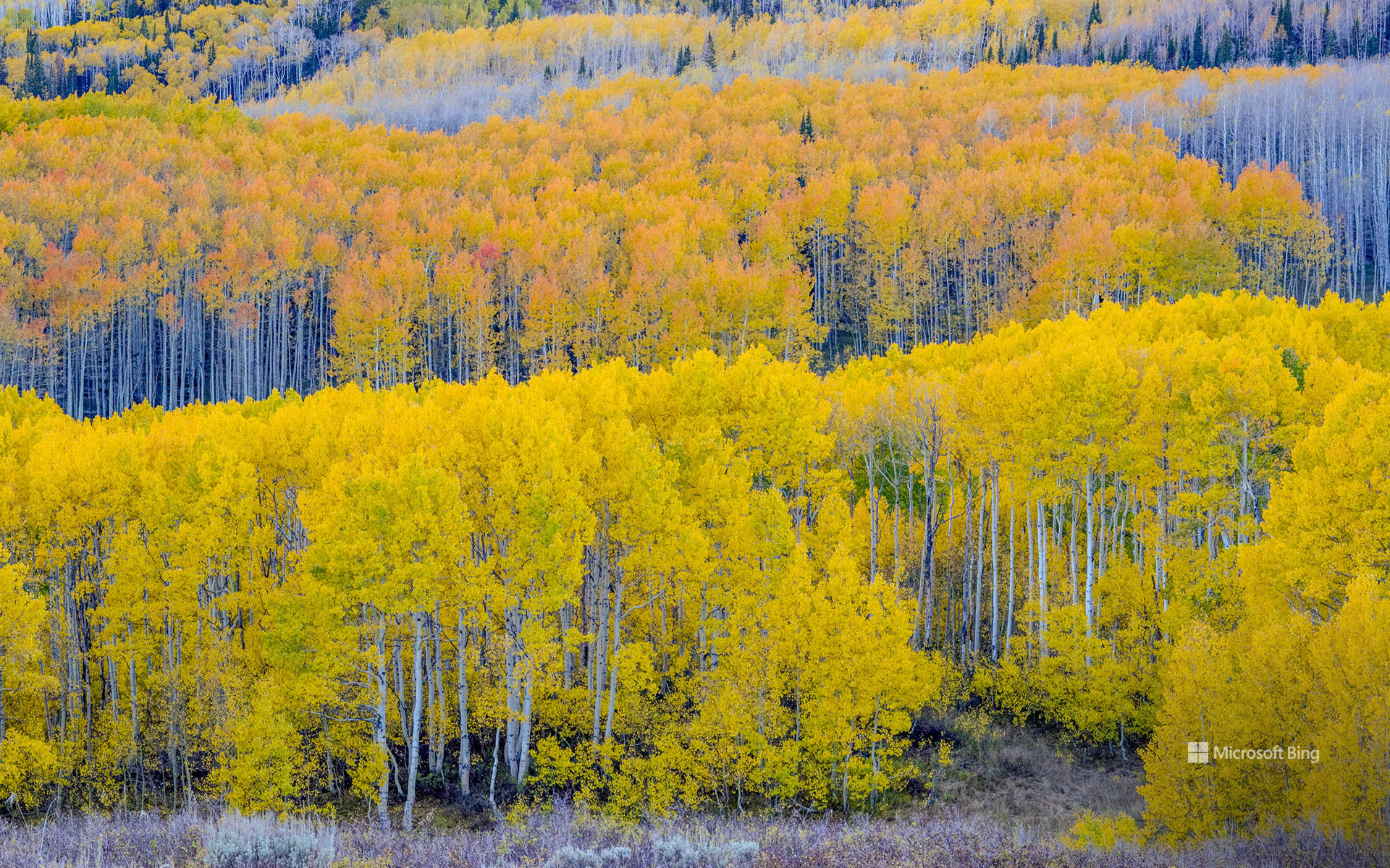
瓜兹曼山口附近的秋日山杨林,犹他州,美国 Fall aspen trees near Guardsman Pass, Utah, USA (© Danita Delimont/Shutterstock)
金色时节 The golden season
瓜兹曼山口,犹他州,美国
在犹他州瓜兹曼山口附近,季节的变化以金色写满山坡。为美国西部染上色彩的山杨中,有许多是美洲山杨——北美分布最广的本土树种。眼前看似由一棵棵独立树木组成的森林,往往有着截然不同的真相:许多山杨形成彼此相连的无性系群落,树干从共享的根系网络中长出,并与相邻树干拥有相同的遗传密码。
即使叶片变黄飘落,这个生物体仍有很大一部分在地下存活。山杨可以依靠根系熬过冬季,静静地为未来的生长做准备。秋分或许宣告夏季结束,但在这些非凡的林地中,生命从未真正停歇。
Autumn equinox
The autumn equinox marks a turning point in the Northern Hemisphere. Occurring each September, it is the moment when the sun crosses the equator heading south, and day and night are nearly equal in length. After this celestial balance, daylight gradually shrinks as the journey toward winter begins.
Near Guardsman Pass in Utah, the change is written across the mountainsides in gold. Many of the aspens coloring the American West are quaking aspens, the most widely distributed native tree species in North America. What appears to be a forest of individuals is often something else entirely: many aspens grow in connected colonies, with trunks emerging from a shared root network and carrying the same genetic code as their neighbors.
Even as their leaves turn yellow and fall, much of the organism remains alive below ground. Aspens can persist through winter via their root systems, quietly preparing for future growth. The autumn equinox may signal summer's end, but in these remarkable groves, life never truly pauses.
郊狼丘,朱红悬崖国家纪念区,亚利桑那州,美国 Coyote Buttes, Vermilion Cliffs National Monument, Arizona, USA (© James Hager/Getty Images)

郊狼丘,朱红悬崖国家纪念区,亚利桑那州,美国 Coyote Buttes, Vermilion Cliffs National Monument, Arizona, USA (© James Hager/Getty Images)
一部守护荒野的法案 An act of wilderness
郊狼丘,朱红悬崖国家纪念区,亚利桑那州
波浪通常属于海洋。但在亚利桑那州北部,它们却从沙漠中涌起。郊狼丘是朱红悬崖国家纪念区的一部分,其盘旋起伏的砂岩地貌由远古沙丘和数百万年的侵蚀共同塑造而成,造就了一片即使静止不动也仿佛泛着涟漪的景观。
正是由于存在这样的地方,1964年《荒野法》才于9月3日签署成为法律,而今天正是纪念这一里程碑的日子。由于担心不断发展的国家可能会改变国土上几乎每一个角落,国会设立了国家荒野保护体系,以保护那些保留自然风貌,并为人们提供独处、探索和发现机会的土地。
该法案最初保护了54片荒野地区,占地910万英亩。六十多年后的今天,这一体系覆盖的全国土地已超过1.1亿英亩。从偏远森林到经自然雕琢的沙漠岩层,这些受保护的景观邀请游客体验美国的另一面——它并非由蓝图塑造,而是由时间本身铸就。
Coyote Buttes, Vermilion Cliffs National Monument, Arizona
Waves usually belong to the ocean. In northern Arizona, they rise from the desert instead. The swirling sandstone formations of Coyote Buttes, part of Vermilion Cliffs National Monument, were shaped by ancient dunes and millions of years of erosion, creating a landscape that seems to ripple even while standing still.
Places like this are one reason the Wilderness Act of 1964 was signed into law on September 3, a milestone commemorated today. Concerned that an expanding nation could transform nearly every corner of the country, Congress established the National Wilderness Preservation System to protect lands that retain their natural character and offer opportunities for solitude, exploration, and discovery.
The act initially safeguarded 54 wilderness areas covering 9.1 million acres. More than six decades later, the system now encompasses over 110 million acres nationwide. From remote forests to sculpted desert rock, these protected landscapes invite visitors to experience a side of America shaped not by blueprints, but by time itself.
红木国家与州立公园的日出,加利福尼亚州,美国 Sunrise in Redwood National and State Parks, California, USA (© HadelProductions/Getty Images)
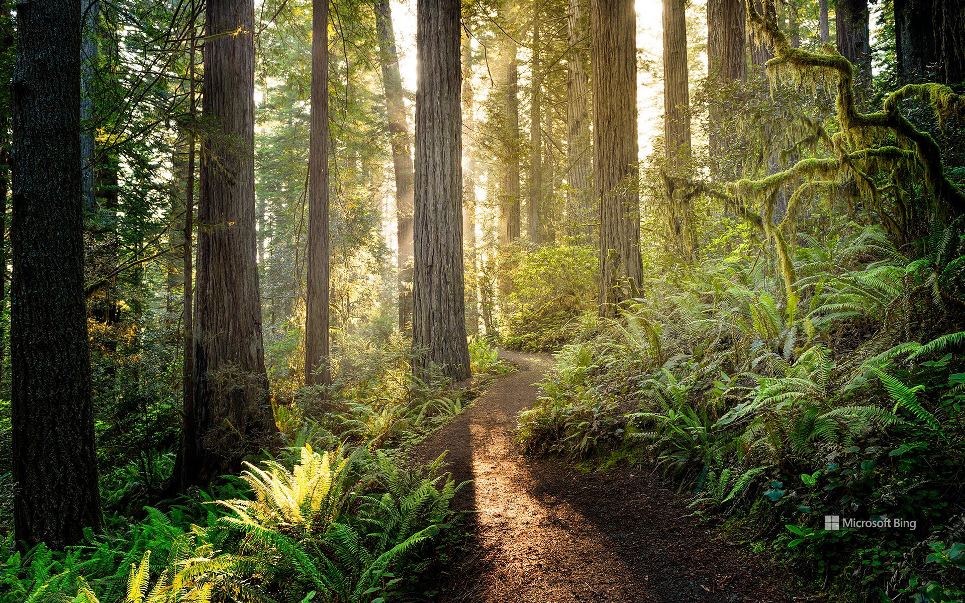
红木国家与州立公园的日出,加利福尼亚州,美国 Sunrise in Redwood National and State Parks, California, USA (© HadelProductions/Getty Images)
守护美国瑰宝 Protecting America's treasures
红杉国家公园与州立公园
110年来,美国最杰出的户外课堂始终向人们开放,供大家探索。8月25日,美国国家公园管理局迎来其守护美国自然与文化瑰宝一个多世纪的纪念日。1916年,伍德罗·威尔逊总统签署《组织法》使其成为法律,该机构由此成立;如今,它负责管理全美数百座公园、纪念地、海滨和历史遗址。由护林员带领的项目、家庭活动和教育活动邀请游客亲近那些塑造了国家公园体系的景观与故事。
今天的图片展示了加利福尼亚州北部的红木国家与州立公园,阳光照亮了一条蜿蜒穿行于地球上一些最高树木之间的小径。高耸的海岸红杉矗立在由蕨类植物和苔藓组成的葱郁林下植被之上,营造出一片既古老又充满生机的森林。这些林地是一个支撑着多种野生动物和数百年古树的生态系统的一部分,展现了美国国家公园管理局世世代代协助保护的自然奇观,也让游客有机会漫步于这些活着的巨树之下,体验一片独一无二的景观。
Anniversary of National Park Service
For 110 years, America's greatest outdoor classroom has been open for exploration. On August 25, the National Park Service marks over a century of protecting the nation's natural and cultural treasures. Established in 1916 when President Woodrow Wilson signed the Organic Act into law, the agency now cares for hundreds of parks, monuments, seashores, and historic sites across the country. Ranger-led programs, family activities, and educational events invite visitors to connect with the landscapes and stories that define the national park system.
Today's image shows Redwood National and State Parks in northern California, where sunlight illuminates a trail winding among some of the tallest trees on Earth. Towering coast redwoods rise above a lush understory of ferns and mosses, creating a forest that feels both ancient and alive. Part of an ecosystem supporting diverse wildlife and centuries-old trees, these groves showcase the natural wonders the National Park Service has helped protect for generations, offering visitors the chance to walk beneath living giants and experience a landscape unlike any other.