桑吉奈尔群岛景观,摄自科西嘉岛,法国 View of the Sanguinaires Islands from Corsica, France (© Francesco Riccardo Iacomino/Getty Images)
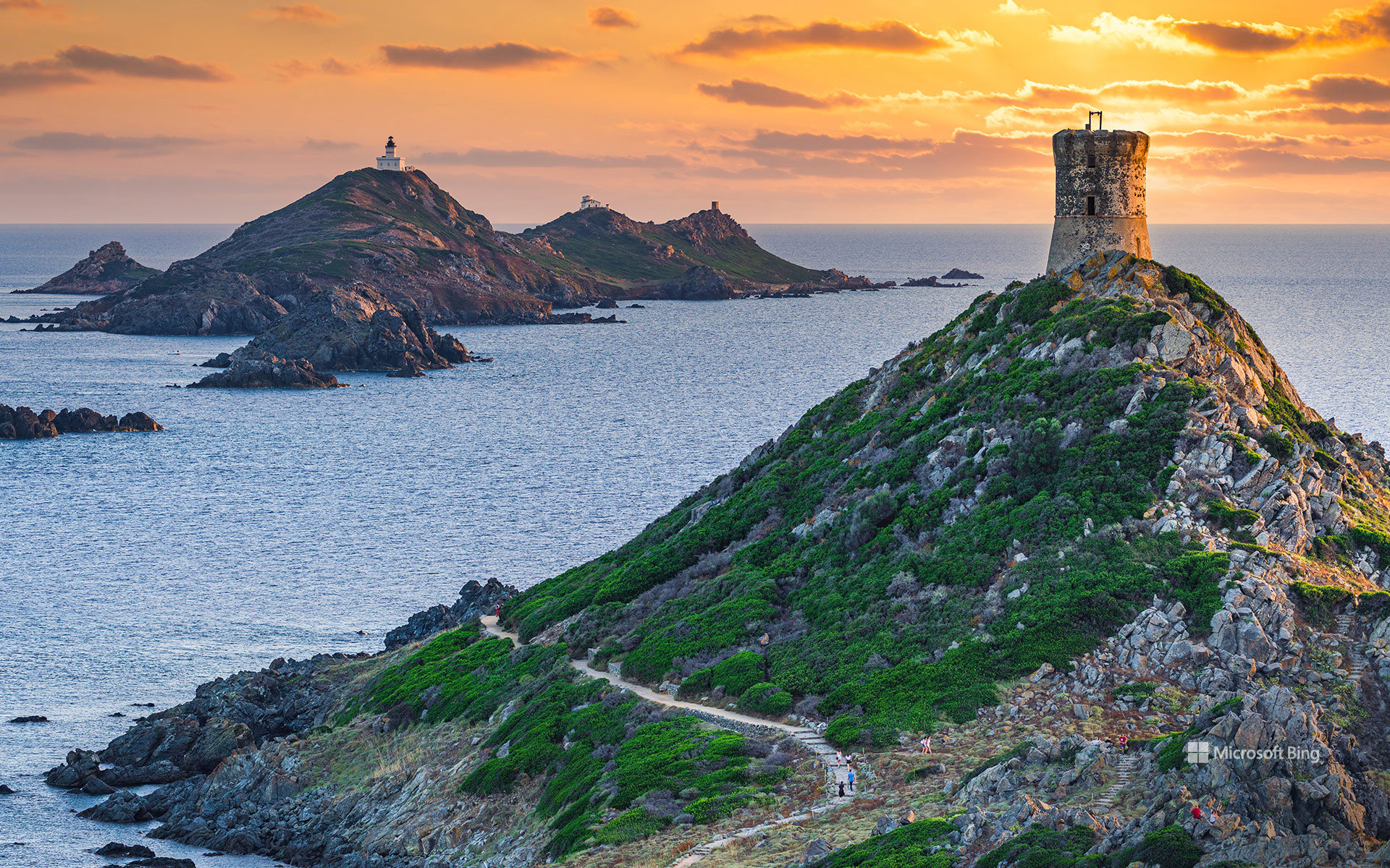
桑吉奈尔群岛景观,摄自科西嘉岛,法国 View of the Sanguinaires Islands from Corsica, France (© Francesco Riccardo Iacomino/Getty Images)
科西嘉岛的岩石前哨 Corsica's rocky outposts
从法国科西嘉岛眺望桑吉奈尔群岛
桑吉奈尔群岛就在法国科西嘉岛近海,从地中海中拔地而起,是一个由四座崎岖岩石岛屿组成的小型群岛。从一座历史悠久的瞭望塔望去,它们坐落在阿雅克肖湾的入口处。陡峭的悬崖、历经数百年的地标和开阔的海景,世世代代吸引着游客来到这一地区。尽管最远的岛屿距离海岸仅约1.2英里,但这片群岛给人的感觉却出奇地偏远:它四周被开阔水域环绕,并受到风、海浪和盐雾的塑造。
游客可以搭乘获准运营的船只前往最大的岛屿梅祖马雷岛,并沿指定步道探索。其他地方的受保护栖息地则为筑巢的海鸟和适应干燥、多风环境的耐寒地中海植物提供庇护。梅祖马雷岛上的一座灯塔令人想起这片群岛悠久的航海历史,以及它位于海湾入口处的战略位置。如今,桑吉奈尔群岛拥有壮丽的景色、野生动物和丰富航海遗产的印记,共同构成了科西嘉岛最令人难忘的自然景观之一。
View of the Sanguinaires Islands from Corsica, France
Just off the coast of Corsica, France, the Sanguinaires Islands rise from the Mediterranean as a small archipelago of four rugged, rocky islands. Viewed from a historic watchtower, they sit at the entrance to the Gulf of Ajaccio. Steep cliffs, centuries-old landmarks, and sweeping sea views have drawn visitors to the area for generations. Though the farthest island lies only about 1.2 miles from shore, the archipelago feels surprisingly remote, surrounded by open water and shaped by wind, waves, and salt spray.
Visitors can reach Mezu Mare, the largest island, via authorized boat services and explore its designated footpaths. Elsewhere, protected habitats provide refuge for nesting seabirds and hardy Mediterranean plants adapted to dry, windswept conditions. A lighthouse on Mezu Mare stands as a reminder of the archipelago's long maritime history and strategic position at the entrance to the gulf. Today, the Sanguinaires Islands offer dramatic scenery, wildlife, and traces of a rich seafaring heritage, creating one of Corsica's most memorable natural landscapes.
覆满苔藓的岩石,英国格洛斯特郡谜林,迪恩森林,格洛斯特郡,英格兰 Moss-covered rocks in Puzzlewood, Forest of Dean, Gloucestershire, England (© Fulcanelli_AOS/Getty Images)
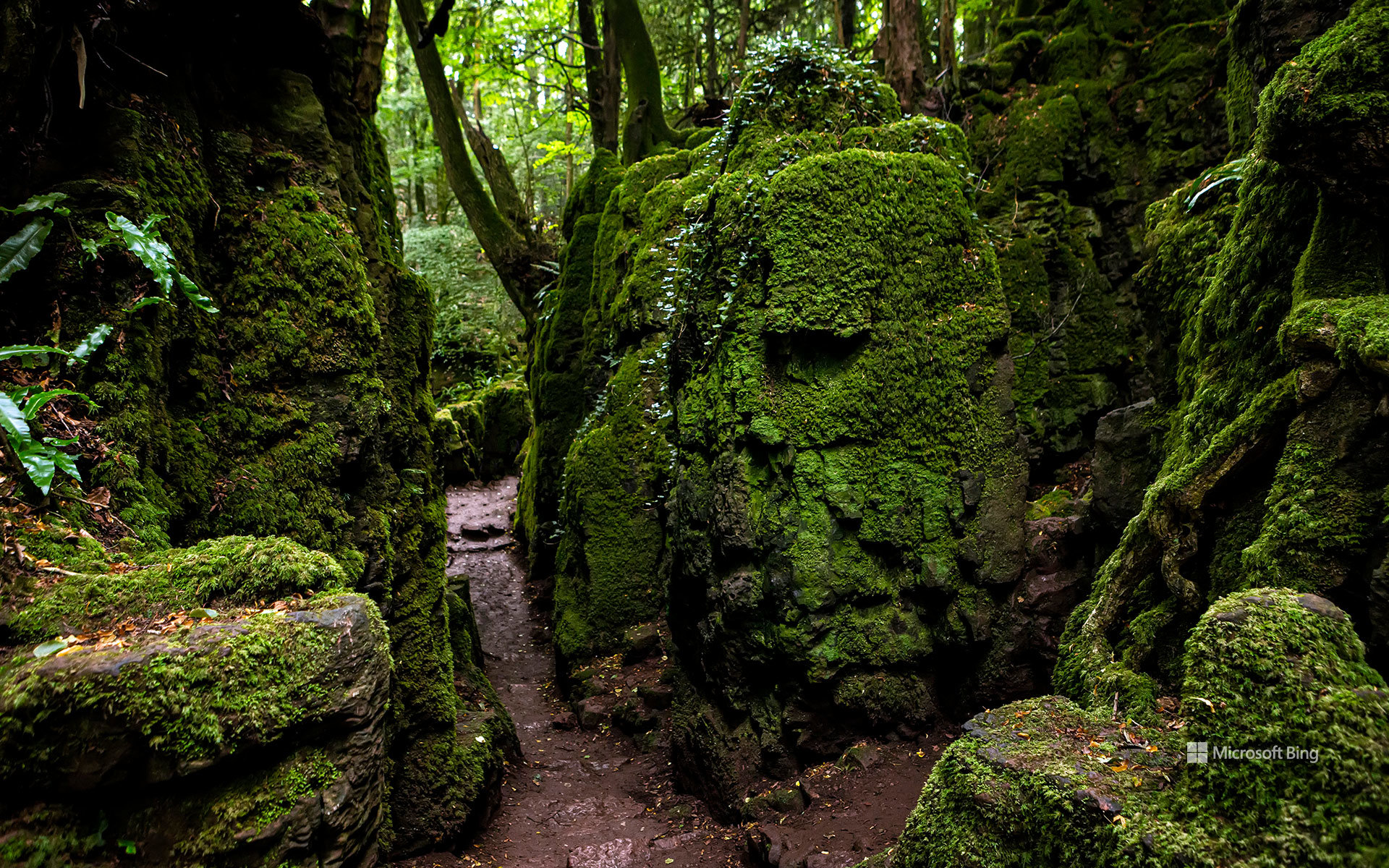
覆满苔藓的岩石,英国格洛斯特郡谜林,迪恩森林,格洛斯特郡,英格兰 Moss-covered rocks in Puzzlewood, Forest of Dean, Gloucestershire, England (© Fulcanelli_AOS/Getty Images)
迷惑不解?沿着小径走 Puzzled? Follow the trail
英国格洛斯特郡谜林,英格兰格洛斯特郡迪恩森林
如果一片森林能让你每转一个弯都捉摸不透,会是什么样?英国格洛斯特郡谜林位于英格兰迪恩森林的科尔福德附近,蜿蜒的小径穿过扭曲的树木、覆满苔藓的岩石和幽深的石质沟壑。这里不同寻常的岩层被称为“斯科尔斯”,是一种天然地质特征,随着时间推移逐渐裸露并发生改变,后来在罗马时期、甚至可能在更早以前被人们开采铁矿石。1848年,一名工人在一个岩洞内的陶罐中发现了3,000多枚罗马时代的钱币,使这片林地变成了一场现实中的寻宝之旅。
约1.5英里长的小径、木桥和石砌步道引导游客穿行于崎岖的地貌之间。英国格洛斯特郡谜林也曾亮相荧屏,出现在《星球大战:原力觉醒》《神秘博士》《梅林传奇》和《天命之咒》中。当地传说认为,这里枝干扭曲的树木和神秘氛围与J.R.R.托尔金笔下中土世界的森林有关,不过并没有确凿证据。
Puzzlewood, Forest of Dean, Gloucestershire, England
What if a forest could keep you guessing at every turn? At Puzzlewood, near Coleford in the Forest of Dean, England, winding paths lead through twisted trees, moss-covered rocks, and deep stone ravines. Its unusual rock formations, known as scowles, are natural geological features that were exposed and modified over time and later exploited for iron ore mining during the Roman period and possibly earlier. In 1848, a worker discovered more than 3,000 Roman-era coins hidden in earthenware jars inside a rock cavity, turning the woodland into a real-life treasure hunt.
Around 1.5 miles of paths, wooden bridges, and stone walkways guide visitors through the rugged landscape. Puzzlewood has also starred on screen, appearing in 'Star Wars: The Force Awakens,' 'Doctor Who,' 'Merlin,' and 'Cursed.' Local lore links its gnarled trees and mysterious atmosphere to J.R.R. Tolkien's Middle-earth forests, although there is no definitive proof.
丹霞地貌,张掖国家地质公园,甘肃省,中国 Danxia landform, Zhangye National Geopark, Gansu, China (© Weiquan Lin/Getty Images)
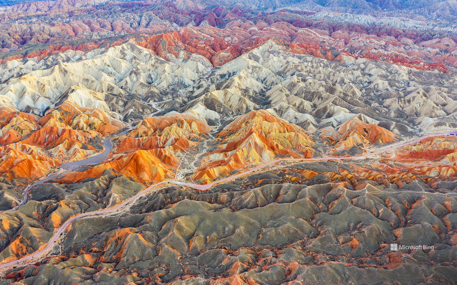
丹霞地貌,张掖国家地质公园,甘肃省,中国 Danxia landform, Zhangye National Geopark, Gansu, China (© Weiquan Lin/Getty Images)
条纹中的地球故事 Earth's story in stripes
国际地质多样性日
如果一座山能用一道道条纹向你展示它的地质历史,会是什么样?在中国的张掖国家地质公园,岩石正是如此。红色、橙色、黄色、棕色以及其他大地色调的条带在山脊间绵延起伏。这种壮丽景观被称为丹霞地貌,由地质年代中沉积形成的多层沉积岩塑造而成。后来,构造力使岩石抬升并发生褶皱,而风化和侵蚀则将它们雕琢成山脊、峭壁、沟壑和山峰。
“丹霞”这个名称的字面意思是玫瑰色的云霞。这些颜色来自岩石本身,其中矿物质和化学过程造就了不同的色调。例如,氧化铁形成了其大部分标志性的红色,而矿物质和沉积物的差异则构成了更加丰富的色彩。
张掖于2020年被指定为联合国教科文组织世界地质公园,坐落在甘肃,这一地区与古丝绸之路有着密切联系。值此国际地质多样性日,它以斑斓的色彩提醒我们:地球最杰出的艺术作品坚如磐石。
International Geodiversity Day
What if a mountain range could show you its geological history in stripes? At Zhangye National Geopark in China, the rocks do exactly that. Ridges roll across the landscape in bands of red, orange, yellow, brown, and other earthy tones. Known as the Danxia landform, this striking landscape was shaped by layers of sedimentary rock deposited over geological time. Tectonic forces later uplifted and folded the rocks, while weathering and erosion carved them into ridges, cliffs, gullies, and peaks.
The name Danxia literally translates to rosy clouds. The colors come from the rocks themselves, with minerals and chemical processes contributing to the different shades. Iron oxides, for instance, are responsible for much of its characteristic red coloring, while variations in minerals and sediment create its broader palette.
Designated as a UNESCO Global Geopark in 2020, Zhangye is located in Gansu, a region linked to the ancient Silk Road. For International Geodiversity Day, it is a colorful reminder that Earth's best artwork is rock-solid.
查图加河,阿巴拉契亚山脉,北卡罗来纳州,美国 Chattooga River in the Appalachian Mountains, North Carolina, USA (© mtilghma/Getty Images)
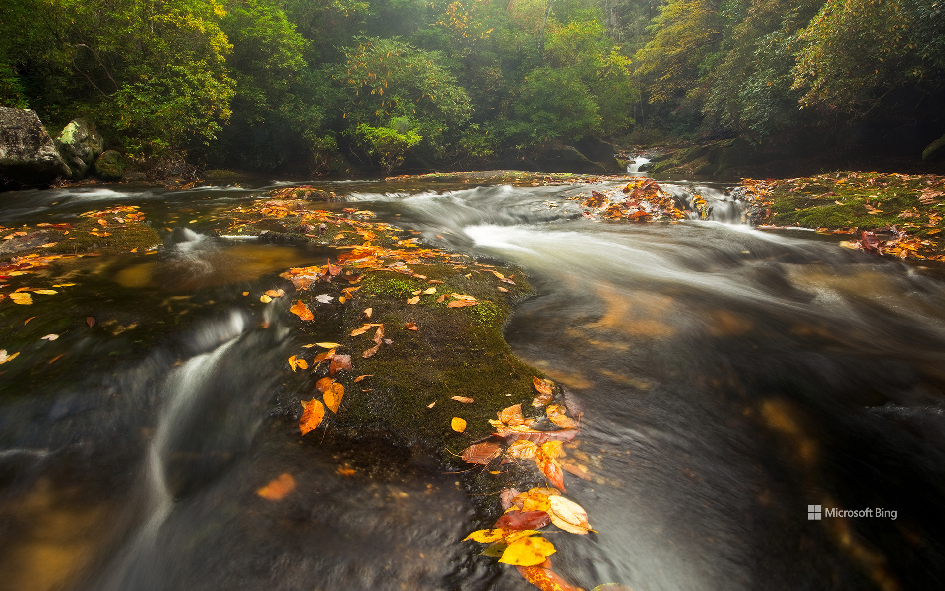
查图加河,阿巴拉契亚山脉,北卡罗来纳州,美国 Chattooga River in the Appalachian Mountains, North Carolina, USA (© mtilghma/Getty Images)
一条值得保护的河流 A river worth protecting
查图加河,美国
长期以来,河流在美国各地的生活中发挥着重要作用,为社区、野生动物和工业提供支持。1968年10月2日,林登·B·约翰逊总统签署《野生与风景河流法》,使其成为法律。该法建立了一个国家体系,用于保护具有卓越景观、休闲、地质、鱼类和野生动物、历史或文化价值的河流及河段。该法使指定河流保持自由流动状态,保护其水质,并旨在守护使它们值得获此指定的特质。
今天的图片展示了查图加河。1974年,该河被纳入这一体系,横跨佐治亚州、北卡罗来纳州和南卡罗来纳州的近57英里河段获指定。查图加河流经阿巴拉契亚山脉,以其风景、激流休闲活动和野生动物而闻名。查图加河常被称为美国东南部的皇冠明珠,可供人们开展漂流、皮划艇和独木舟运动。它甚至还是詹姆斯·迪基1970年小说《Deliverance》中虚构的卡胡拉瓦西河的原型。
Wild and Scenic Rivers Act
Rivers have long played an important role in life across the United States, supporting communities, wildlife, and industry. President Lyndon B. Johnson signed the Wild and Scenic Rivers Act into law on October 2, 1968. It created a national system to protect rivers and river segments with outstanding scenic, recreational, geologic, fish and wildlife, historic, or cultural values. The Act preserves designated rivers in a free-flowing condition, protects their water quality, and aims to safeguard the qualities that made them worthy of designation.
Featured in today's image, the Chattooga River became part of the system in 1974, with nearly 57 miles designated across Georgia, North Carolina, and South Carolina. Flowing through the Appalachian Mountains, the river is known for its scenery, whitewater recreation, and wildlife. Often called the crown jewel of the Southeast, the Chattooga offers opportunities for rafting, kayaking, and canoeing. It even served as the model for the fictional Cahulawassee River in James Dickey's 1970 novel 'Deliverance.'
奥姆斯特德观景点的日落,优胜美地国家公园,加利福尼亚州,美国 Sunset from Olmsted Point, Yosemite National Park, California, USA (© Robb Hirsch/Tandem Stills + Motion)
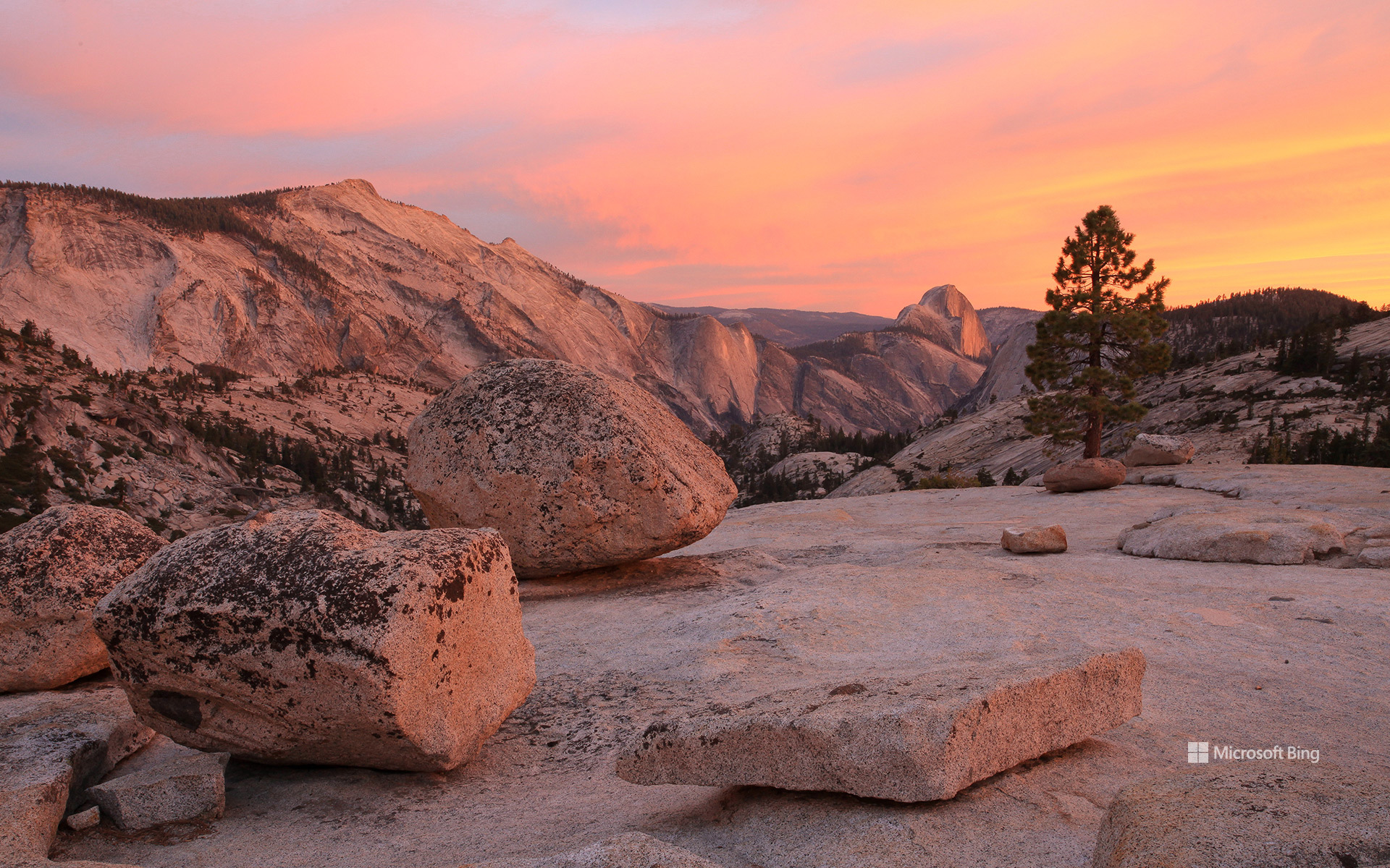
奥姆斯特德观景点的日落,优胜美地国家公园,加利福尼亚州,美国 Sunset from Olmsted Point, Yosemite National Park, California, USA (© Robb Hirsch/Tandem Stills + Motion)
在花岗岩中读懂时间 Reading time in granite
优胜美地国家公园纪念日
从这里望去,优胜美地一些最著名的地标也呈现出截然不同的一面。通常所见的半穹顶从优胜美地山谷上方拔地而起,而在这里,它露出陡峭的北壁,让这个熟悉的标志性景观看起来几乎令人感到陌生。远处还有特纳亚峡谷、云歇峰、特纳亚湖,以及记录着数百万年隆升、侵蚀与冰川作用的浅色岩石。奥姆斯特德观景点得名于景观设计师弗雷德里克·劳·奥姆斯特德及其子小弗雷德里克·劳·奥姆斯特德;父子二人的自然保护工作推动了美国国家公园运动的发展。这里提醒着人们:优胜美地不仅景色壮美,还是一片仍在以岩石讲述自身故事的土地。
Yosemite National Park anniversary
On October 1, 1890, Yosemite became the nation's third national park. More than a century later, it still feels like a place that operates on geological time rather than human schedules. From Olmsted Point, the overlook in today's image, that timescale is impossible to miss. The smooth granite underfoot was sculpted by glaciers, while scattered boulders known as glacial erratics were carried here by ice and abandoned when it melted.
The view also turns some of Yosemite's most famous landmarks inside out. Half Dome, usually seen rising above Yosemite Valley, reveals its sheer north face from here, making the familiar icon look almost unfamiliar. Beyond it lie Tenaya Canyon, Clouds Rest, Tenaya Lake, and pale stone that records millions of years of uplift, erosion, and ice. Named for landscape architect Frederick Law Olmsted and his son, Frederick Law Olmsted Jr., whose conservation work helped shape America's park movement, Olmsted Point offers a reminder that Yosemite is not just scenic; it is a landscape still telling its story in stone.
卡西洛夫河冰川融水滋养的湛蓝河水,阿拉斯加州,美国 The blue, glacier-fed waters of the Kasilof River, Alaska, USA (© jared lloyd/Getty Images)
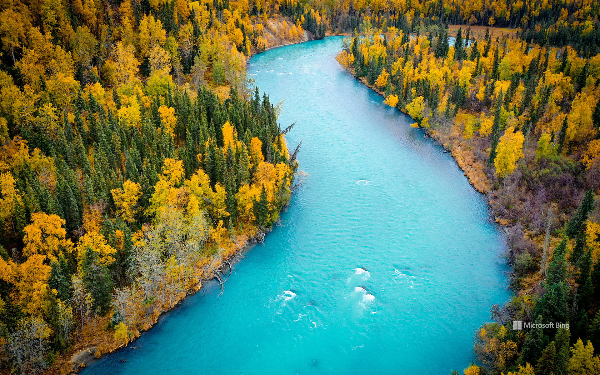
卡西洛夫河冰川融水滋养的湛蓝河水,阿拉斯加州,美国 The blue, glacier-fed waters of the Kasilof River, Alaska, USA (© jared lloyd/Getty Images)
冰川孕育之河 Born of glaciers
阿拉斯加州卡西洛夫河由冰川补给的蓝色河水
从空中俯瞰,卡西洛夫河宛如一条绿松石色的丝带,蜿蜒穿过阿拉斯加州的基奈半岛。鲜艳的蓝色河水源于从图斯图梅纳湖向下游输送的冰川粉砂;该湖是阿拉斯加州最大的淡水湖之一。河流全长约17英里,最终注入库克湾。它虽比著名的邻河基奈河短,却同样不同凡响。
卡西洛夫河发源于冰塑地貌,与当地的渔业文化始终密不可分。长期以来,这条河一直是德纳伊纳人的重要资源,后来又成为商业捕捞、生计捕捞和休闲垂钓的重地。如今,垂钓者为洄游的鲑鱼而来,游客则可探索附近的休闲场所、露营地和自然步道。卡西洛夫社区本身是半岛西海岸的一座小渔镇;这里的河流、森林和河口栖息地滋养着丰富的野生动物。无论从漂流艇上还是空中观赏,卡西洛夫河都能让人鲜明地窥见阿拉斯加的冰川起源,以及这片土地与水之间绵延不绝的联系。
The blue, glacier-fed waters of the Kasilof River, Alaska
Seen from above, the Kasilof River winds like a ribbon of turquoise through Alaska's Kenai Peninsula. The vivid blue water comes from glacial silt carried downstream from Tustumena Lake, one of the largest freshwater lakes in the state. Flowing about 17 miles before emptying into Cook Inlet, the river is shorter than its famous neighbor, the Kenai, but no less remarkable.
The Kasilof begins in a landscape shaped by ice and remains closely tied to the region's fishing culture. Long an important resource for the Dena'ina people, the river later became central to commercial, subsistence, and recreational fishing. Today, anglers come for salmon runs, while visitors explore nearby recreation sites, campgrounds, and nature trails. The community of Kasilof itself is a small fishing town on the peninsula's west coast, where river, forest, and estuary habitats support abundant wildlife. Whether viewed from a drift boat or from the air, the Kasilof offers a striking glimpse of Alaska's glacial origins and enduring connection to the water.
斋浦尔附近琥珀堡内的 Sattais Katcheri 大厅,拉贾斯坦邦,印度 Sattais Katcheri Hall in Amber Fort near Jaipur, Rajasthan, India (© R.M. Nunes/Getty Images)
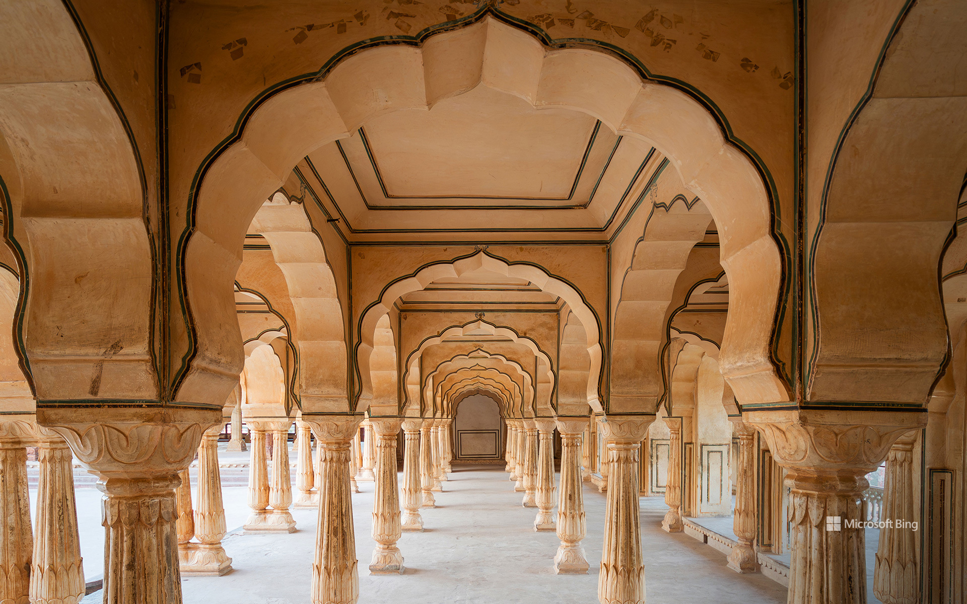
斋浦尔附近琥珀堡内的 Sattais Katcheri 大厅,拉贾斯坦邦,印度 Sattais Katcheri Hall in Amber Fort near Jaipur, Rajasthan, India (© R.M. Nunes/Getty Images)
可览美景的历史胜地 History with a view
印度拉贾斯坦邦斋浦尔附近的琥珀堡
大多数初次到访印度拉贾斯坦邦斋浦尔的游客都知道这座城市有“粉红之城”的美誉,但更早的王都以琥珀堡为中心。这个王朝的大部分政治与建筑史正是在那里书写的。琥珀堡的营建历时一个多世纪,始于1592年拉贾·曼·辛格一世统治时期,之后由历代卡奇瓦哈统治者续建;他们统治的王国后来成为斋浦尔土邦。王室于 1727 年迁往新规划的斋浦尔城,但琥珀堡仍继续承担礼仪功能。
从建筑上看,这座堡垒将拉杰普特式防御特色与受莫卧儿风格启发的拱门、庭院、彩绘表面和大理石装饰融为一体。图中的Sattais Katcheri大厅因其27根柱子而得名。这座建筑被认为曾用于行政事务。堡内还有觐见厅、王室庭院以及装饰华丽的镜宫。探索这片宏大的建筑群,感受“Padharo Sa”的热情好客,也别忘了留点肚子品尝一盘达尔巴蒂楚尔玛——烤小麦面团、扁豆和一种香甜松散的甜点。
Amber Fort near Jaipur, Rajasthan, India
Most first-time visitors know Jaipur, in Rajasthan, India, as the Pink City, but the earlier royal capital was centered on Amber Fort. That's where much of the dynasty's political and architectural history was shaped. The fort developed over more than a century, beginning under Raja Man Singh I in 1592 and continuing under later Kachwaha rulers who controlled the kingdom that eventually became Jaipur State. The royal family moved to the newly planned city of Jaipur in 1727, but Amber continued to serve ceremonial functions.
Architecturally, the fort combines defensive Rajput features with Mughal-inspired arches, courtyards, painted surfaces, and marble detailing. The Sattais Katcheri Hall, seen in the image, takes its name from its 27 pillars. The structure is associated with administrative purposes. The fort also includes audience halls, royal courtyards, and the ornate Sheesh Mahal. Explore the sprawling complex, experience the warmth of 'Padharo Sa,' and save room for a plate of dal baati churma—baked wheat dumplings, lentils, and a sweet crumbly dessert.
熊耳国家纪念区附近的雪松台地和骡子角,犹他州,美国 Cedar Mesa and Muley Point near Bears Ears National Monument, Utah, USA (© Jeff Clay/Tandem Stills + Motion)
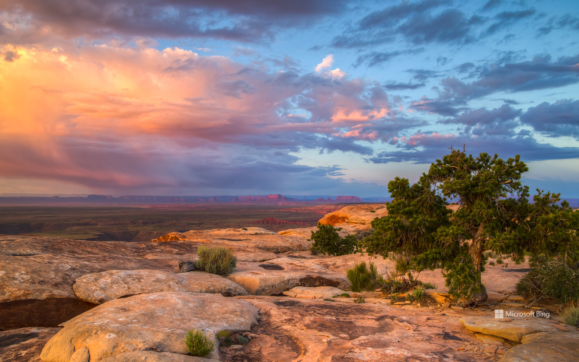
熊耳国家纪念区附近的雪松台地和骡子角,犹他州,美国 Cedar Mesa and Muley Point near Bears Ears National Monument, Utah, USA (© Jeff Clay/Tandem Stills + Motion)
写在大地上的故事 The stories written across the land
美国国家公共土地日
熊的耳朵、着火的房屋和遍布急转弯的道路有什么共同之处?它们都是犹他州东南部公共土地故事的一部分。
在国家公共土地日,雪松台地及附近的骡子角展现出古老历史与高地沙漠风光的非凡交融。熊耳国家纪念区拥有重要的文化和自然资源,其中包括反映数千年人类历史的考古遗址。它的名字源于两座形似熊耳的孤峰。
National Public Lands Day
What do a bear's ears, a house on fire, and a road packed with hairpin turns have in common? They're all part of the story of southeastern Utah's public lands.
On National Public Lands Day, Cedar Mesa and nearby Muley Point offer a remarkable mix of ancient history and high-desert scenery. Bears Ears National Monument encompasses important cultural and natural resources, including archaeological sites that reflect thousands of years of human history. Its name comes from twin buttes that resemble a bear's ears.
Rising to roughly 6,500 feet, Cedar Mesa is carved by deep canyons, including Grand Gulch, an archaeological treasure trove. Mule Canyon's House on Fire gets its name from sandstone that glows orange in morning light. Nearby Muley Point overlooks the San Juan River, Valley of the Gods, Monument Valley, and Navajo Mountain. Reaching it via the steep, unpaved Moki Dugway gives new meaning to the word 'switchback.'
庆祝中秋节的中国灯笼 Chinese lanterns for Mid-Autumn Festival celebration (© LeeYiuTung/Getty Images)

庆祝中秋节的中国灯笼 Chinese lanterns for Mid-Autumn Festival celebration (© LeeYiuTung/Getty Images)
当月亮也来赴会 When the moon joins the party
中秋节
如果满月是你家宴上的贵宾,会是什么情景?这正是中秋节的意蕴,中秋节也被称为月亮节。这个节日在农历八月十五庆祝,是中国文化中最重要的节日之一。它的源头可追溯至3,000多年前周朝时期的祭月仪式。最广为人知的传说讲述了嫦娥服下长生不老药后飞上月宫的故事。
月饼是这一节日最具代表性的美食。圆圆的外形象征着圆满与团聚。民间传说称,元朝时期,反抗者曾把推翻蒙古统治者的秘密消息藏在月饼里。
这个节日还催生了牵线结缘的习俗,因此被比作月亮版的情人节。尽管中秋月以明亮著称,科学却告诉我们,它不一定是一年中最亮的月亮。传说、灯笼和月饼汇聚于此,这个节日确实值得人们抬头仰望。
Mid-Autumn Festival
What if the full moon were the guest of honor at your family dinner? That is the idea behind the Mid-Autumn Festival, also known as the Moon Festival. Celebrated on the 15th day of the eighth lunar month, it is one of the most important festivals in Chinese culture. Its roots trace back more than 3,000 years to moon-honoring rituals during the Zhou Dynasty. Its best-known legend tells of Chang'e, who drank an elixir of immortality and rose to the moon.
Mooncakes are the celebration's signature treat. Their round shape symbolizes completeness and reunion. Folklore claims that rebels once hid secret messages to overthrow the Mongol rulers inside mooncakes during the Yuan Dynasty.
The festival has also inspired matchmaking customs, earning comparisons to a lunar Valentine's Day. And while the Mid-Autumn moon is celebrated for its brightness, science says it is not necessarily the year's brightest. With legends, lanterns, and mooncakes, this festival has plenty to look up to.
黑色熔岩海滩鸟瞰图,埃尔戈尔福,兰萨罗特岛,加那利群岛,西班牙 Aerial view of black lava beach, El Golfo, Lanzarote, Canary Islands, Spain (© Westend61/Adobe Stock)
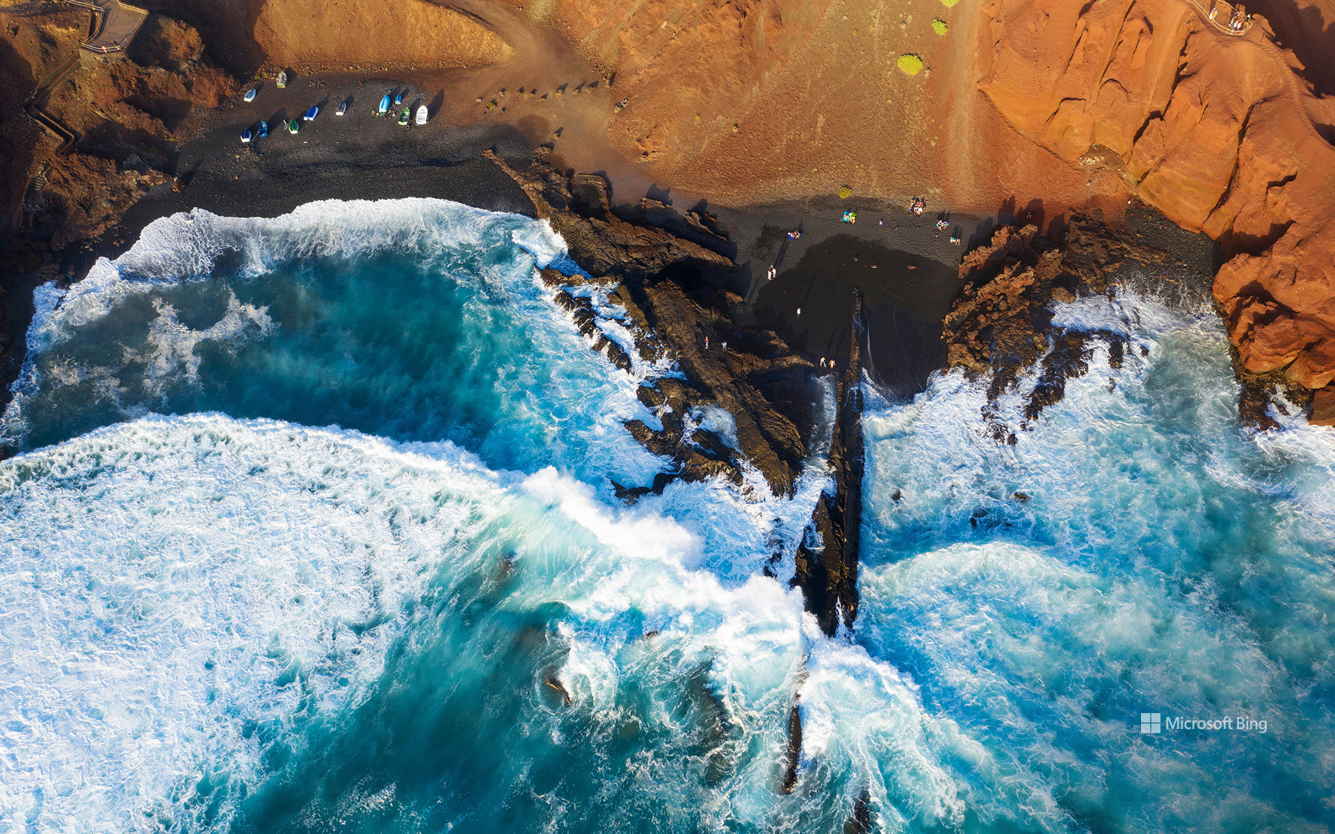
黑色熔岩海滩鸟瞰图,埃尔戈尔福,兰萨罗特岛,加那利群岛,西班牙 Aerial view of black lava beach, El Golfo, Lanzarote, Canary Islands, Spain (© Westend61/Adobe Stock)
黑色熔岩海滩, 加那利群岛,西班牙
在西班牙加那利群岛的兰萨罗特岛,大自然的地质创造力尽情挥洒。赭黄与铁锈色条纹交错的悬崖之下,深色沙滩与大西洋相接,这是延续数百万年的火山活动留下的杰作。这段地质故事中有一章发生在距今并不久远的年代:1730年至1736年间,兰萨罗特岛各处出现了众多火山喷口,熔岩覆盖数十平方英里的土地,掩埋了道路、村庄和农田。
图中的海滩坐落在埃尔戈尔福旁边,这是岛屿西岸的一个小渔村。村庄毗邻洛斯火山自然公园,而船只、海鲜餐厅和拍岸浪涛一如往常,仿佛眼前的景色再平常不过。附近著名的绿色潟湖查尔科德洛斯克利科斯位于一座部分坍塌的火山口内,并通过地下裂隙与大海相连。湖水那令人难以置信的翡翠色部分源于藻类,让碧绿湖水、黑色沙滩与蓝色大海同框,构成一幅色彩鲜明夺目的画面。无需滤镜。埃尔戈尔福自带专属调色盘。
Black lava beach, El Golfo, Lanzarote, Canary Islands, Spain
On Lanzarote, part of Spain's Canary Islands, geology got carried away. Dark sand meets the Atlantic beneath cliffs streaked with ocher and rust, the handiwork of volcanic activity spanning millions of years. One chapter of this story arrived remarkably recently: between 1730 and 1736, numerous vents opened across Lanzarote, sending lava over dozens of square miles and burying roads, villages, and farmland.
The beach in the image sits beside El Golfo, a tiny fishing village on the island's western shore. The settlement borders Los Volcanes Natural Park, while boats, seafood restaurants, and crashing waves carry on as if this scenery were perfectly ordinary. Nearby, the famous green lagoon Charco de los Clicos occupies a partially collapsed volcanic crater linked to the sea through underground fissures. Its improbable emerald color comes partly from algae, bringing green water, black sand, and blue sea into one strikingly vivid frame. No filter required. El Golfo comes with its own color palette.