东米恩南唐斯国家公园谷物田中的山毛榉树,汉普郡,英格兰 Beech tree in a cereal field, East Meon, South Downs National Park, Hampshire, England (© Guy Edwardes/Minden Pictures)

东米恩南唐斯国家公园谷物田中的山毛榉树,汉普郡,英格兰 Beech tree in a cereal field, East Meon, South Downs National Park, Hampshire, England (© Guy Edwardes/Minden Pictures)
金色田野 Fields of gold
汉普郡谷物田中的山毛榉树,英格兰
在汉普郡东米恩附近的金色田野中,一棵山毛榉独自挺立,成为英格兰南唐斯国家公园起伏景观中的醒目焦点。数百年来,农业塑造着这些白垩丘陵;时至今日,耕作仍是该地区的重要组成部分。当地排水良好的白垩土壤支撑着大规模旱作农业,其中小麦和大麦是最常见的作物。整个夏季,作物在田间逐渐成熟,随后收获季将乡野变成金色田块与麦茬交织的拼图。
9月初正值主要收获季,乡村社区开始庆祝一年的丰收。在东米恩等村庄,收获传统仍是当地生活中经久不衰的一部分,反映出土地与耕作者之间的深厚联系。以开阔天空和连绵农田为背景,这棵孤树象征着南唐斯悠久的农业遗产。
Beech tree in a cereal field, Hampshire, England
A beech tree stands alone amid golden fields near East Meon in Hampshire, providing a striking focal point in the rolling landscape of England's South Downs National Park. Agriculture has shaped these chalk hills for centuries, and farming remains an important part of the region today. The area's free-draining chalk soils support extensive arable farming, with wheat and barley among the most common crops. Throughout the summer, these crops ripen in the fields before harvest transforms the countryside into a patchwork of gold and stubble.
Early September coincides with the main harvest season, when rural communities begin celebrating the year's bounty. In villages such as East Meon, harvest traditions remain an enduring part of local life, reflecting the deep connection between the land and the people who work it. Framed by open skies and sweeping farmland, this solitary tree stands as a symbol of the South Downs' long agricultural heritage.
老市政厅,班贝格,德国 Old Town Hall, Bamberg, Germany (© SCStock/Getty Images)

老市政厅,班贝格,德国 Old Town Hall, Bamberg, Germany (© SCStock/Getty Images)
历史沿运河流淌之地 Where history flows along the canal
老市政厅,班贝格,德国
班贝格老市政厅高踞于雷格尼茨河上,是德国班贝格最具代表性的地标之一。当地传说称,这座建筑之所以矗立在人工岛上,是因为城里的主教拒绝向市民提供修建市政厅的土地。据说居民于是自行在河中央造出一块地基,成就了这座建筑非凡的环境和历久弥新的魅力。
这座建筑融合了哥特式和巴洛克式建筑元素,色彩缤纷的外墙上装饰着精美的湿壁画。一座石桥将市政厅与历史城区两岸相连,构成巴伐利亚最常被拍摄的景观之一。
如今,老市政厅仍是班贝格丰富遗产与独特气质的象征。周围蜿蜒的街道、历史建筑和河畔风光,让人得以一窥当地数百年的历史,并继续吸引着来自世界各地的游客。
菲安斯湖,格兰屏国家公园,维多利亚州,澳大利亚 Lake Fyans, Grampians National Park, Victoria, Australia (© tracielouise/Getty Images)

菲安斯湖,格兰屏国家公园,维多利亚州,澳大利亚 Lake Fyans, Grampians National Park, Victoria, Australia (© tracielouise/Getty Images)
倒影满湖的水库 A reservoir of reflections
菲安斯湖,格兰屏国家公园,维多利亚州,澳大利亚
乍看之下,今天的画面更像一片被淹没的林地,而不是湖泊。光秃的树干从水中伸出,倒影横贯水面,远处的格兰屏群山熠熠生辉。这里是菲安斯湖,一座位于澳大利亚维多利亚州格兰屏(加里维德)国家公园边缘的人工水库。这里深受划船者、垂钓者、帆船爱好者和滑水者欢迎,也为人们提供了欣赏澳大利亚最壮美景观之一的绝佳前排视角。
湖泊远处的群山属于格兰屏山脉,这条山脉历经数亿年塑造而成。如今,该地区以崎岖的砂岩山峰、壮观的观景台、瀑布和丰富的澳大利亚原住民文化遗产闻名。步道纵横交错,带领徒步者欣赏开阔景致,并邂逅袋鼠、鸸鹋及其他本土鸟类。菲安斯湖将这种荒野精神浓缩在同一幅画面中:被淹没的树木、开阔的天空,以及以古老群山构成的瞬息万变的背景。
Lake Fyans, Grampians National Park, Victoria, Australia
At first glance, today's image looks more like a drowned woodland than a lake. Bare tree trunks emerge from the water, their reflections stretching across the surface as the Grampians glow in the distance. This is Lake Fyans, an artificial reservoir on the edge of the Grampians (Gariwerd) National Park in Victoria, Australia. Popular with boaters, anglers, sailors, and water-skiers, it offers a front-row seat to one of the country's most striking landscapes.
The mountains beyond the lake are part of the Grampians, a range shaped over hundreds of millions of years. Today, the region is known for its rugged sandstone peaks, dramatic lookouts, waterfalls, and rich Aboriginal cultural heritage. Trails crisscross the park, leading hikers to sweeping views and encounters with kangaroos, emus, and other native birds. Lake Fyans captures that wild spirit in a single scene: flooded trees, open skies, and an ever-changing backdrop of ancient mountains.
韦斯特黑弗的韦斯特黑弗桑德灯塔,石勒苏益格-荷尔斯泰因州,德国 Westerheversand Lighthouse in Westerhever, Schleswig-Holstein, Germany (© bluejayphoto/Getty Images)

韦斯特黑弗的韦斯特黑弗桑德灯塔,石勒苏益格-荷尔斯泰因州,德国 Westerheversand Lighthouse in Westerhever, Schleswig-Holstein, Germany (© bluejayphoto/Getty Images)
地平线上的红与白 Red and white on the horizon
韦斯特黑弗桑德灯塔, 德国
韦斯特黑弗桑德灯塔高耸于德国北海沿岸的盐沼之上,凭借醒目的红白条纹一眼便可辨认。灯塔建于1906年至1908年间,一个多世纪以来一直是艾德施泰特半岛的标志,为穿行北海水域的船只指引航向。如今,它仍是德国北部最著名的海岸地标之一。登上157级台阶的游客,可以饱览周围的壮阔景色。
一条狭窄的潮汐水道蜿蜒穿过沼泽,将视线引向远处的条纹灯塔。周围景观属于石勒苏益格-荷尔斯泰因瓦登海国家公园,并位于已列入联合国教科文组织《世界遗产名录》的瓦登海之中。受潮汐持续律动的塑造,这片非凡的海岸环境会随着水位涨落在一天中不断变化。盐沼和广阔潮滩孕育了丰富多样的野生动物,使瓦登海成为世界上最重要的湿地生态系统之一。
Westerheversand Lighthouse, Schleswig-Holstein, Germany
Rising above the salt marshes along Germany's North Sea coast, the Westerheversand Lighthouse is instantly recognizable thanks to its distinctive red-and-white stripes. Built between 1906 and 1908, the lighthouse has stood as an icon on the Eiderstedt Peninsula for more than a century, guiding ships through the waters of the North Sea. Today, it remains one of northern Germany's best-known coastal landmarks. Visitors who climb its 157 steps are rewarded with sweeping views of the surrounding scenery.
A narrow tidal channel meanders through the marshland, leading the eye toward the striped beacon in the distance. The surrounding landscape is part of the Schleswig-Holstein Wadden Sea National Park, within the UNESCO World Heritage-listed Wadden Sea. Shaped by the constant rhythm of tides, this remarkable coastal environment changes throughout the day as water levels rise and fall. Salt marshes and extensive tidal flats support a rich variety of wildlife, making the Wadden Sea one of the world's most important wetland ecosystems.
郊狼丘,朱红悬崖国家纪念区,亚利桑那州,美国 Coyote Buttes, Vermilion Cliffs National Monument, Arizona, USA (© James Hager/Getty Images)

郊狼丘,朱红悬崖国家纪念区,亚利桑那州,美国 Coyote Buttes, Vermilion Cliffs National Monument, Arizona, USA (© James Hager/Getty Images)
一部守护荒野的法案 An act of wilderness
郊狼丘,朱红悬崖国家纪念区,亚利桑那州
波浪通常属于海洋。但在亚利桑那州北部,它们却从沙漠中涌起。郊狼丘是朱红悬崖国家纪念区的一部分,其盘旋起伏的砂岩地貌由远古沙丘和数百万年的侵蚀共同塑造而成,造就了一片即使静止不动也仿佛泛着涟漪的景观。
正是由于存在这样的地方,1964年《荒野法》才于9月3日签署成为法律,而今天正是纪念这一里程碑的日子。由于担心不断发展的国家可能会改变国土上几乎每一个角落,国会设立了国家荒野保护体系,以保护那些保留自然风貌,并为人们提供独处、探索和发现机会的土地。
该法案最初保护了54片荒野地区,占地910万英亩。六十多年后的今天,这一体系覆盖的全国土地已超过1.1亿英亩。从偏远森林到经自然雕琢的沙漠岩层,这些受保护的景观邀请游客体验美国的另一面——它并非由蓝图塑造,而是由时间本身铸就。
Coyote Buttes, Vermilion Cliffs National Monument, Arizona
Waves usually belong to the ocean. In northern Arizona, they rise from the desert instead. The swirling sandstone formations of Coyote Buttes, part of Vermilion Cliffs National Monument, were shaped by ancient dunes and millions of years of erosion, creating a landscape that seems to ripple even while standing still.
Places like this are one reason the Wilderness Act of 1964 was signed into law on September 3, a milestone commemorated today. Concerned that an expanding nation could transform nearly every corner of the country, Congress established the National Wilderness Preservation System to protect lands that retain their natural character and offer opportunities for solitude, exploration, and discovery.
The act initially safeguarded 54 wilderness areas covering 9.1 million acres. More than six decades later, the system now encompasses over 110 million acres nationwide. From remote forests to sculpted desert rock, these protected landscapes invite visitors to experience a side of America shaped not by blueprints, but by time itself.
雷吉斯坦广场的建筑细节,撒马尔罕,乌兹别克斯坦 Building detail of Registan Square, Samarkand, Uzbekistan (© Piero M. Bianchi/Getty Images)

雷吉斯坦广场的建筑细节,撒马尔罕,乌兹别克斯坦 Building detail of Registan Square, Samarkand, Uzbekistan (© Piero M. Bianchi/Getty Images)
图案艺术的典范 A master class in pattern
雷吉斯坦广场的建筑细节
站在雷吉斯坦广场上,你很容易明白为什么这里被视为撒马尔罕的建筑核心——撒马尔罕是中亚最古老的城市之一。这座位于乌兹别克斯坦的广场三面矗立着三座宏伟的经学院——伊斯兰学术中心——它们高耸的门廊吸引着人们仰头观望。然而,广场上一些最珍贵的瑰宝,只有在你走近细看时才会显露出来。
今日图片中的细节让我们得以一窥几乎遍布每一处表面的精美艺术。琉璃砖、几何图案、花卉纹饰和优雅的书法以非凡的精确度融为一体,将砖石与灰泥化作绚丽夺目的色彩和图案展示。绿松石色、钴蓝色、金色和白色的色调随着光线变化而流转,使建筑在一天之中呈现出一种动态之感。
这些经学院最初作为学习和宗教学术研究中心而建,环绕着一座热闹的公共广场;这里曾是丝绸之路沿线的生活中心。如今,雷吉斯坦依然同样引人入胜,吸引游客欣赏其宏伟的规模和非凡的工艺。
Building detail of Registan Square, Samarkand, Uzbekistan
Stand in Registan Square and it's easy to see why it is considered the architectural heart of Samarkand—one of Central Asia's oldest cities. This plaza in Uzbekistan is framed by three magnificent madrasas—Islamic centers of learning—whose soaring portals draw the eye upward. Yet some of the square's greatest treasures reveal themselves only when you look closer.
The detail in today's image offers a glimpse of the artistry that covers nearly every surface. Glazed tiles, geometric motifs, floral designs, and elegant calligraphy come together with remarkable precision, turning brick and plaster into a dazzling display of color and pattern. Shades of turquoise, cobalt, gold, and white shift with the changing light, giving the architecture a sense of movement throughout the day.
Built as centers of learning and religious scholarship, the madrasas surrounded a lively public square that was once a focal point of life along the Silk Road. Today, Registan remains just as captivating, inviting visitors to admire both its monumental scale and its extraordinary craftsmanship.
冲浪者航拍图,圣卡塔琳娜州,巴西 Aerial view of surfers, Santa Catarina, Brazil (© Wonderful Nature/Shutterstock)

冲浪者航拍图,圣卡塔琳娜州,巴西 Aerial view of surfers, Santa Catarina, Brazil (© Wonderful Nature/Shutterstock)
读懂浪涛之间的讯息 Reading between the waves
冲浪者航拍图,圣卡塔琳娜州,巴西
在巴西南部圣卡塔琳娜州近海,图片捕捉到一种熟悉的仪式:冲浪者在碎浪之外等待,冲浪板随着大西洋的波涛起伏。从空中看,几乎什么都没有发生,但真正的功课正是在此时开始。
每一道海浪都携带着风所产生的能量,而那阵风可能来自数百甚至数千英里之外。挑战在于恰好在正确的时刻迎上这股远道而来的脉动。风、潮汐、洋流和海床形态共同决定每一道涌浪如何破碎;一个细微变化,就可能让完美的滑行变成翻滚的白浪。
很少有海岸线能比圣卡塔琳娜州更充分地展现这种多样性。这里拥有200多座海滩,从适合初学者的柔和浪点到世界级的管浪一应俱全。看似是一项运动,实则是在学习一种完全由流动海水诉说的语言。最优秀的冲浪者并不只是更强壮或更迅速,而是最懂得倾听的人。
Aerial view of surfers, Santa Catarina, Brazil
Off the coast of Santa Catarina, a state in southern Brazil, the image captures a familiar ritual: surfers waiting beyond the breaking waves, their boards rising and falling with the Atlantic. From above, almost nothing seems to happen. But that's when the real work begins.
Every wave carries energy generated by wind that may have blown hundreds or even thousands of miles away. The challenge is meeting that traveling pulse at just the right moment. Wind, tides, currents, and the shape of the seafloor determine how each swell will break, and a subtle shift can turn a perfect ride into tumbling whitewater.
Few coastlines showcase that variety better than Santa Catarina. With more than 200 beaches, it produces everything from gentle beginner breaks to world-class barrels. What looks like a sport is really learning a language spoken entirely in moving water. The best surfers aren't simply stronger or faster. They're the ones who know how to listen.
涨潮时的圣米歇尔山,芒什省,诺曼底,法国 Mont-Saint-Michel during high tide, Manche, Normandy, France (© Clement LEONARD/Getty Images)

涨潮时的圣米歇尔山,芒什省,诺曼底,法国 Mont-Saint-Michel during high tide, Manche, Normandy, France (© Clement LEONARD/Getty Images)
潮汐塑造的传奇 Where tides shape a legend
涨潮时的圣米歇尔山,诺曼底,法国
日落时分,圣米歇尔山从法国诺曼底的水面升起,宛如一座由海洋塑造的堡垒。修道院和村庄坐落在岩石潮汐岛上,矗立于欧洲最壮观的海岸环境之一。每天两次,海水退去,露出大片沙滩;随后潮水再次涌回,重新覆盖这片景观。涨潮时,圣米歇尔山又会变成一座岛屿。数百年来,旅行者一直根据这种潮汐节奏安排行程,在条件允许时穿越潮滩,并在数小时后观看海水归来。
传说这里的起源可追溯到708年:大天使米迦勒向一位主教显现,并指示他在此建造一座圣所。随着时间推移,这里发展为欧洲最重要的朝圣地之一。如今,圣米歇尔山及其周边海湾已被列入联合国教科文组织《世界遗产名录》;数百年的历史与潮汐运动仍在塑造每一次到访体验。
Mont-Saint Michel during high tide, Normandy, France
At sunset, Mont-Saint Michel rises from the waters of Normandy, France, like a fortress shaped by the sea. Perched on a rocky tidal island, the abbey and village stand at the center of one of Europe's most dramatic coastal settings. Twice a day, the sea retreats to reveal vast stretches of sand before surging back to reclaim the landscape. At high tide, the mount becomes an island once again. For centuries, travelers timed their journeys to this rhythm, crossing the flats when conditions allowed and watching the sea return hours later.
A legend traces the site's origins to the year 708, when the Archangel Michael appeared to a bishop and instructed him to build a sanctuary here. Over time, the site grew into one of Europe's most important pilgrimage destinations. Today, Mont-Saint Michel and its surrounding bay are recognized as a UNESCO World Heritage Site, where centuries of history and the movement of the tides continue to shape every visit.
基尔丘山上空的极光,冰岛 Auroras over Kirkjufell, Iceland (© Cavan Images/Alamy)

基尔丘山上空的极光,冰岛 Auroras over Kirkjufell, Iceland (© Cavan Images/Alamy)
流光溢彩的天空 A sky alive with color
基尔丘山上空的极光,冰岛
随着冰岛的夜晚再次变长,游客很快又会仰望天空,期待一睹北极光。北极光是一种发光现象,当来自太阳的粒子与地球高层大气中的气体相互作用时,便会形成闪烁的绿色、粉色、紫色,有时甚至是红色光带。冰岛地处北方,秋冬季夜晚日益漫长而黑暗,因此成为全球首屈一指的极光观赏地之一。
在这片不断变化的光幕之下,矗立着冰岛最常被拍摄的山峰之一——基尔丘山。它的冰岛语名称意为“教堂山”,源于其酷似教堂的外形。基尔丘山耸立在斯奈山半岛之上,醒目的轮廓和附近的基尔丘瀑布使这里深受摄影师和极光追寻者喜爱。在晴朗的夜晚,山峰、瀑布与天空交相辉映,构成一幅近乎不真实的画面;这一非凡组合已成为冰岛最具标志性的景观之一。
Auroras over Kirkjufell, Iceland
As darker nights return to Iceland, visitors will soon look to the skies for a chance to see the aurora borealis. Better known as the northern lights, this luminous phenomenon occurs when particles from the sun interact with gases high in Earth's atmosphere, creating shimmering ribbons of green, pink, purple, and sometimes red light. Iceland's northern location and increasingly dark autumn and winter nights make it one of the world's premier destinations for aurora viewing.
Beneath this ever-changing display stands Kirkjufell, one of the country's most photographed mountains. Its name means 'Church Mountain' in Icelandic, inspired by its church-like shape. Rising above the Snæfellsnes Peninsula, its striking silhouette and the nearby Kirkjufellsfoss waterfall have made the area a favorite of photographers and aurora seekers alike. On clear nights, the mountain, waterfall, and sky align in a scene that seems almost unreal—a remarkable combination that has become one of Iceland's most iconic views.
红木国家与州立公园的日出,加利福尼亚州,美国 Sunrise in Redwood National and State Parks, California, USA (© HadelProductions/Getty Images)
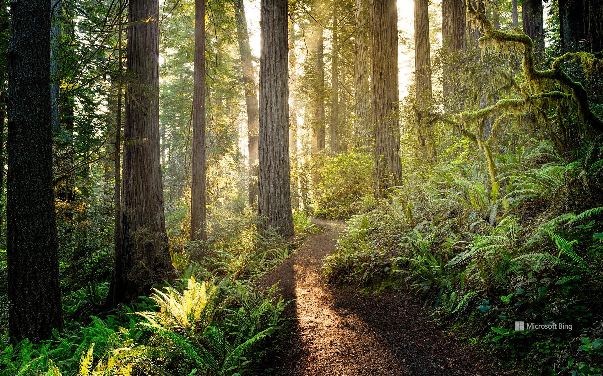
红木国家与州立公园的日出,加利福尼亚州,美国 Sunrise in Redwood National and State Parks, California, USA (© HadelProductions/Getty Images)
守护美国瑰宝 Protecting America's treasures
红杉国家公园与州立公园
110年来,美国最杰出的户外课堂始终向人们开放,供大家探索。8月25日,美国国家公园管理局迎来其守护美国自然与文化瑰宝一个多世纪的纪念日。1916年,伍德罗·威尔逊总统签署《组织法》使其成为法律,该机构由此成立;如今,它负责管理全美数百座公园、纪念地、海滨和历史遗址。由护林员带领的项目、家庭活动和教育活动邀请游客亲近那些塑造了国家公园体系的景观与故事。
今天的图片展示了加利福尼亚州北部的红木国家与州立公园,阳光照亮了一条蜿蜒穿行于地球上一些最高树木之间的小径。高耸的海岸红杉矗立在由蕨类植物和苔藓组成的葱郁林下植被之上,营造出一片既古老又充满生机的森林。这些林地是一个支撑着多种野生动物和数百年古树的生态系统的一部分,展现了美国国家公园管理局世世代代协助保护的自然奇观,也让游客有机会漫步于这些活着的巨树之下,体验一片独一无二的景观。
Anniversary of National Park Service
For 110 years, America's greatest outdoor classroom has been open for exploration. On August 25, the National Park Service marks over a century of protecting the nation's natural and cultural treasures. Established in 1916 when President Woodrow Wilson signed the Organic Act into law, the agency now cares for hundreds of parks, monuments, seashores, and historic sites across the country. Ranger-led programs, family activities, and educational events invite visitors to connect with the landscapes and stories that define the national park system.
Today's image shows Redwood National and State Parks in northern California, where sunlight illuminates a trail winding among some of the tallest trees on Earth. Towering coast redwoods rise above a lush understory of ferns and mosses, creating a forest that feels both ancient and alive. Part of an ecosystem supporting diverse wildlife and centuries-old trees, these groves showcase the natural wonders the National Park Service has helped protect for generations, offering visitors the chance to walk beneath living giants and experience a landscape unlike any other.